|
search place name
|
||
Balās (‘Adan, Yemen)Balās is a town in the ‘Adan region of Yemen. An overview map of the region around Balās is displayed below.
regional and 3d topo map of Balās, Yemen ::
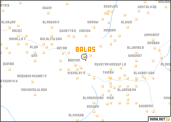
Nearby towns ::
Ḑirwah (1.6km north east) //
Z̧ahrān (1.9km north) //
Umm Jawl (1.8km south west) //
Barkan (2.4km south west) //
Ahl Hādī (2.6km south west) //
Ahl Ḩunaysh (2.6km south west) //
Al ‘Alam (3.0km south) //
Dhū aţ Ţalab (4.0km north west) //
Al Hajar al ‘Ulyā (4.0km north west) //
Sahir (4.0km south west) //
Ḩişn al ‘Ayn (4.1km south west) //
‘Uruffān (4.1km south east) //
Umm Hajrīyah (4.6km north east) //
‘Aryab (5.1km west) //
Al Madmanah (5.4km west) //
Karīsh (5.6km north) //
Al Qaryah (5.7km west) //
Mukaymah as Suflá (5.7km east) //
Umm Naḩr (6.0km north west) //
Thirah (6.2km south east) //
Dhī Masal (6.5km north east) //
Bilād ash Shuhūr (6.6km north west) //
Sumayţah (6.6km north west) //
Ahl Juḩayf (6.6km south east) //
Sākin al Maḩrūq (6.5km south east) //
Umm Mishqālah (7.1km south east) //
Harāwī (7.6km north) //
Umm Ḑayq (7.7km north east) //
Maqwām (7.7km north east) //
[all distances 'as the bird flies' and approximate] 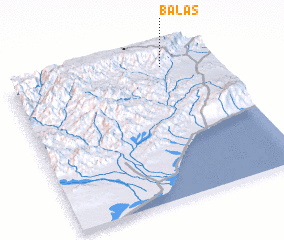 Places with similar names to Balās, Yemen ::
Disclaimer :: Information on this page comes without warranty of any kind |
||
|
Where is Balās? Elevation and coordinates ::
Latitude (lat): 13°55'0"N Longitude (lon): 45°45'0"E
Elevation (approx.): 2255m (map arrows pan, magnifying glasses zoom) |
||
|
Visiting Balās? Hotel/Accommodation ::
Book a hotel in Balās Travel Guide ::
Buy a travel guide for Yemen rental cars ::
car rental offers GPS waypoint ::
download a GPX waypoint (PoI) of Balās for your GPS receiver
|
||