|
search place name
|
||
Bayt ad Dālī (Al Ḩudaydah, Yemen)Bayt ad Dālī is a town in the Al Ḩudaydah region of Yemen. An overview map of the region around Bayt ad Dālī is displayed below.
regional and 3d topo map of Bayt ad Dālī, Yemen ::

Nearby towns ::
Maḩwá al Musharri‘ (0.9km east) //
Shi‘b ad Dālī (1.4km west) //
Ar Radādīyah (2.2km south west) //
Al Jirbah (2.4km north east) //
Al Maḩşīm (2.6km north west) //
Al Munjīyah (2.8km north east) //
Al ‘Arīsh (2.9km west) //
Bayt al Kamāl (3.2km south east) //
Bayt al Ḩawālī (3.2km north west) //
Murshidīyah (3.5km north) //
Ar Rawḑah (3.5km north east) //
Maḩall ash Shaykh (3.7km north west) //
Qaryat al ‘Abīd (3.7km west) //
Qaryat ‘Āmir (3.9km north east) //
Maḩall aţ Tawīl (3.9km north west) //
Muqayşi‘ (3.8km east) //
Al Jirb al Asfal (3.8km west) //
Şayābah (4.3km south west) //
Al Jarr (4.4km south east) //
Sūq Muha (4.4km north) //
‘Āmir A‘lá (4.5km north) //
Al Ma‘āmirah (4.8km west) //
Raqm Wāḩid (4.9km east) //
Dayr Sayf (5.1km north east) //
Maḩwā al Musaylah (5.3km north) //
Bukayr an Najāḩ (5.3km north) //
Bayt Shirayhid (5.4km south west) //
Maḩjār ar Rayyān (5.5km north west) //
Al Jarrāḩī (5.4km west) //
[all distances 'as the bird flies' and approximate] 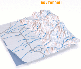 Places with similar names to Bayt ad Dālī, Yemen ::
Disclaimer :: Information on this page comes without warranty of any kind |
||
|
Where is Bayt ad Dālī? Elevation and coordinates ::
Latitude (lat): 14°8'38"N Longitude (lon): 43°26'37"E
Elevation (approx.): 228m (map arrows pan, magnifying glasses zoom) |
||
|
Visiting Bayt ad Dālī? Hotel/Accommodation ::
Book a hotel in Bayt ad Dālī Travel Guide ::
Buy a travel guide for Yemen rental cars ::
car rental offers GPS waypoint ::
download a GPX waypoint (PoI) of Bayt ad Dālī for your GPS receiver
|
||