|
search place name
|
||
Bayt al Qāmūs (Yemen)Bayt al Qāmūs is a town in Yemen. An overview map of the region around Bayt al Qāmūs is displayed below.
regional and 3d topo map of Bayt al Qāmūs, Yemen ::

Bayt al Qāmūs airports ::
The nearest airport is GIZ - Gizan King Abdullah Bin Abdulaziz, located 235.0 km north west of Bayt al Qāmūs.
Nearby towns ::
Al Ḩaţab (1.3km north) //
Aḑ Ḑahrah (1.4km south) //
Thimād (2.0km south west) //
Bayt Shimrān (2.1km west) //
Sanaf (2.3km north) //
Al Hajarah (2.7km east) //
Waşl (3.7km south west) //
Mawsanah (4.7km north east) //
‘Arjaz (5.3km south east) //
Matwaḩ (5.3km west) //
Manākhah (5.3km east) //
Al Ya‘ābir (5.4km east) //
Al Marzamah (6.3km west) //
Banī Shubāţī (6.4km south east) //
Za‘lāʼ (6.3km west) //
Al Jirwah (6.7km west) //
Lakamat al Mi‘qāb (6.8km east) //
Az̧ Z̧ahrah (7.1km east) //
Qarn Hāshim (7.1km west) //
Taym (7.2km south west) //
Ḩuţayb (7.2km east) //
Banī Murrah (7.3km east) //
Ash Sharaf (7.3km west) //
Bayt al Mud‘ī (7.5km north east) //
Sharaf (7.6km north east) //
Sihan ad Dauma (7.8km south) //
Al Maghārib (7.9km south west) //
Bayt Sanāḩ (8.5km south) //
Aş Şalūl (8.4km east) //
[all distances 'as the bird flies' and approximate] 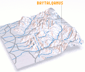 Places with similar names to Bayt al Qāmūs, Yemen :: Disclaimer :: Information on this page comes without warranty of any kind |
||
|
Where is Bayt al Qāmūs? Elevation and coordinates ::
Latitude (lat): 15°3'58"N Longitude (lon): 43°41'29"E
Elevation (approx.): 2224m (map arrows pan, magnifying glasses zoom) |
||
|
Visiting Bayt al Qāmūs? Hotel/Accommodation ::
Book a hotel in Bayt al Qāmūs Travel Guide ::
Buy a travel guide for Yemen rental cars ::
car rental offers GPS waypoint ::
download a GPX waypoint (PoI) of Bayt al Qāmūs for your GPS receiver
|
||