|
search place name
|
||
Dayr Kuddaf (Al Ḩudaydah, Yemen)Dayr Kuddaf is a town in the Al Ḩudaydah region of Yemen. An overview map of the region around Dayr Kuddaf is displayed below.
regional and 3d topo map of Dayr Kuddaf, Yemen ::

Nearby towns ::
Dayr ‘Alī Ţāhir (1.6km north) //
Dayr Ḩusaytayn (1.6km south) //
Qaryat al Battārah (1.7km north) //
Dayr al Hudayah (2.1km west) //
Al Midman (2.4km south) //
Dayr al Maqbūl (2.6km north east) //
Bayt al Manāmah (2.9km east) //
Dayr al Qammād (3.2km north west) //
Al ‘Uqārīyah (3.6km south east) //
Dayr al Muzabbal (3.8km east) //
Al Madāfin (4.0km south east) //
Al ‘Uwayşāʼ (4.2km south) //
Al Ḩajjāmah (4.3km south west) //
Al Ḩarīq (4.5km east) //
Al Maḩallatayn (4.7km north) //
Al Maḩall at Tayn (4.7km north) //
Şanif ‘Aţīyah (4.9km east) //
As Sunayyif (5.3km south east) //
Dayr Dāwid (5.2km west) //
Al Mişbār (5.4km north east) //
Al Maḩjūr (5.6km south) //
Aḑ Ḑubāratayn (5.5km south east) //
Dayr al Bukārīyīn (5.7km south west) //
As Sawlah (5.8km south east) //
Al Mudmin (5.8km east) //
Al Miqşāb (6.1km north east) //
Al Ḩabīl (6.1km south east) //
Shujaynah (6.2km west) //
Dayr al Walī (6.2km south west) //
[all distances 'as the bird flies' and approximate] 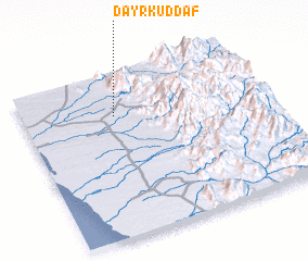
Disclaimer :: Information on this page comes without warranty of any kind |
||
|
Where is Dayr Kuddaf? Elevation and coordinates ::
Latitude (lat): 14°44'52"N Longitude (lon): 43°22'52"E
Elevation (approx.): 184m (map arrows pan, magnifying glasses zoom) |
||
|
Visiting Dayr Kuddaf? Hotel/Accommodation ::
Book a hotel in Dayr Kuddaf Travel Guide ::
Buy a travel guide for Yemen rental cars ::
car rental offers GPS waypoint ::
download a GPX waypoint (PoI) of Dayr Kuddaf for your GPS receiver
|
||