|
search place name
|
||
Ghafir (Yemen)Ghafir is a town in Yemen. An overview map of the region around Ghafir is displayed below.
regional and 3d topo map of Ghafir, Yemen ::

Nearby towns ::
Al Heyatfe (2.5km east) //
Mansibah (2.6km south west) //
Dār al Ushaw (3.0km south east) //
Al Ḩaḑan (3.0km west) //
‘Amid (3.6km north east) //
Bisarif (4.9km south east) //
Ḩālah (5.0km north) //
Al Ḩusayn (5.1km south west) //
Banī Hamar (5.1km south west) //
Ḑawmarān (5.3km south west) //
Ribāţ al Ma‘zibī (5.3km south west) //
Ja‘ar (5.3km west) //
Ash Shamāḩī (5.3km north east) //
Marşabah (5.8km north east) //
Bakhrān (5.8km east) //
Bayt al Ba‘m (6.1km south) //
Al Kitar (6.2km south) //
Ash Sharyah (6.1km north west) //
Wardasān (6.3km south east) //
Dishunigran (6.5km south) //
Zi Alul (6.7km south west) //
Māriyah (6.7km north west) //
Al Merard (6.6km west) //
Dafīnah (7.2km north) //
Māriyah (7.2km north west) //
Ḩijrah (7.4km south) //
Dhī Saḩr (7.2km north east) //
‘Aşfirān (7.4km south west) //
Al ‘Adan (7.2km south west) //
[all distances 'as the bird flies' and approximate] 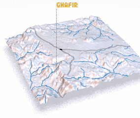 Places with similar names to Ghafir, Yemen ::
Disclaimer :: Information on this page comes without warranty of any kind |
||
|
Where is Ghafir? Elevation and coordinates ::
Latitude (lat): 14°27'16"N Longitude (lon): 44°18'37"E
Elevation (approx.): 2536m (map arrows pan, magnifying glasses zoom) |
||
|
Visiting Ghafir? Hotel/Accommodation ::
Book a hotel in Ghafir Travel Guide ::
Buy a travel guide for Yemen rental cars ::
car rental offers GPS waypoint ::
download a GPX waypoint (PoI) of Ghafir for your GPS receiver
|
||