|
search place name
|
||
Ḩabīl ‘Awd (Yemen)Ḩabīl ‘Awd is a town in Yemen. An overview map of the region around Ḩabīl ‘Awd is displayed below.
regional and 3d topo map of Ḩabīl ‘Awd, Yemen ::

Nearby towns ::
Al Ghayl (2.4km north east) //
Nuqub (2.7km north east) //
Tuwanah (3.2km south east) //
Ḩilīyah (3.7km north east) //
Ḩabīl as Sūq (3.9km east) //
Al Ḩabīlayn (4.0km east) //
Alela (4.6km north west) //
Al Ma‘āmir (5.4km south east) //
Habilai (5.8km south east) //
Al Ḩamrāʼ (5.8km south east) //
Al ‘Ulūb (5.8km south east) //
Ar Rabābah (5.9km east) //
Al Qaflah (6.1km north) //
Aş Şafrāʼ (6.2km south east) //
Dār Sulayk (6.2km south east) //
Ath Thumayr (6.5km south east) //
Al Milāḩ (7.1km south east) //
Al Jabhah (7.1km south east) //
Jamal (7.3km south east) //
Jawl Ahl Waḩadah (7.5km east) //
Aḑ Ḑubayyāt (7.8km north west) //
Lubaynīyah (7.8km east) //
Ruhbah (8.1km west) //
Daqqat Bujayr (8.3km east) //
Shi‘b ad Dīwān (8.7km south east) //
Aţ Ţawfah (8.8km north) //
Matwad (8.6km south east) //
Ar Rawayd (9.0km south east) //
Al Ḩummaydah (8.8km north east) //
[all distances 'as the bird flies' and approximate] 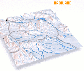
Disclaimer :: Information on this page comes without warranty of any kind |
||
|
Where is Ḩabīl ‘Awd? Elevation and coordinates ::
Latitude (lat): 13°33'20"N Longitude (lon): 44°48'52"E
Elevation (approx.): 720m (map arrows pan, magnifying glasses zoom) |
||
|
Visiting Ḩabīl ‘Awd? Hotel/Accommodation ::
Book a hotel in Ḩabīl ‘Awd Travel Guide ::
Buy a travel guide for Yemen rental cars ::
car rental offers GPS waypoint ::
download a GPX waypoint (PoI) of Ḩabīl ‘Awd for your GPS receiver
|
||