|
search place name
|
||
Ḩişn Bishr (Ḩaḑramawt, Yemen)Ḩişn Bishr is a town in the Ḩaḑramawt region of Yemen. An overview map of the region around Ḩişn Bishr is displayed below.
regional and 3d topo map of Ḩişn Bishr, Yemen ::

Ḩişn Bishr airports ::
The nearest airport is SHW - Sharurah, located 232.7 km north west of Ḩişn Bishr.
Nearby towns ::
‘Arḑ Bū Zayd (1.6km east) //
Diyār Bin Sulaymān (2.1km south east) //
Ar Rawḑah (2.1km south east) //
Al Fidāʼ (2.1km west) //
Al Khudūd (2.5km south west) //
Al Munīf (2.7km north east) //
Qar‘ān (3.2km east) //
Al Bilād (3.2km east) //
Diyār Āl Nāşir (3.3km east) //
Laqrān (3.3km east) //
Laḩmas (3.4km north west) //
Ghumdān (3.6km south east) //
Sufaylah (3.9km south west) //
Baḩrān Bin Thābit (4.1km north) //
Ḩawţat al Ḩuwaymil (4.1km north) //
Ḩawrāʼ (4.7km north east) //
Dār al Ḩijl (5.0km south west) //
Al Qabḑayn (5.3km south) //
Ath Thijjah (5.3km north east) //
Diyār Āl Buqrī (5.3km north east) //
Al Qufl (5.5km north) //
Al Khurj (5.5km south) //
Lahrum (5.4km west) //
Qārat Āl Makhāshin (5.6km north east) //
Sharāḩ (6.0km north) //
An Naq‘ah (6.0km north) //
Qarn Bin Shaykhān (6.0km south east) //
Ash Sharqīyah (6.3km south west) //
Al Qārah (7.1km north) //
[all distances 'as the bird flies' and approximate] 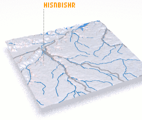 Places with similar names to Ḩişn Bishr, Yemen :: Disclaimer :: Information on this page comes without warranty of any kind |
||
|
Where is Ḩişn Bishr? Elevation and coordinates ::
Latitude (lat): 15°40'46"N Longitude (lon): 48°16'9"E
Elevation (approx.): 722m (map arrows pan, magnifying glasses zoom) |
||
|
Visiting Ḩişn Bishr? Hotel/Accommodation ::
Book a hotel in Ḩişn Bishr Travel Guide ::
Buy a travel guide for Yemen rental cars ::
car rental offers GPS waypoint ::
download a GPX waypoint (PoI) of Ḩişn Bishr for your GPS receiver
|
||