|
search place name
|
||
Maharar (‘Adan, Yemen)Maharar is a town in the ‘Adan region of Yemen. An overview map of the region around Maharar is displayed below.
regional and 3d topo map of Maharar, Yemen ::

Nearby towns ::
Ad Darb (1.1km south east) //
Majran (1.5km north) //
Dār Ḩawrah (1.8km west) //
Al Maşna‘ah (1.9km south) //
Dār al Maţāḩin (1.9km north) //
Darja Nishff (2.6km north east) //
Ma‘fārī (2.6km north west) //
Tanasham (2.6km north west) //
Shabwān (2.6km south west) //
Al Kurb (3.3km north east) //
Al Ḩablah (3.6km south west) //
Al Kaba (3.7km south) //
Habal Abd (3.7km south) //
Ataʼma (4.1km north west) //
Al Ḩarf (4.1km south west) //
Wa‘lān (4.1km south west) //
Al Azāriq (4.1km south west) //
Al Qaflah (4.1km south west) //
Al Marsaba (4.1km north east) //
Hajar (4.1km north east) //
‘Arsh (4.1km south west) //
Maḑīq (4.1km south west) //
Muqtar (4.5km south) //
Zinad (4.5km east) //
Khushān (4.7km south) //
Aḑ Ḑāli‘ (5.4km north) //
Talat (5.6km north) //
Dafēr (5.4km east) //
Ḩişn Di Ishad (5.8km north) //
[all distances 'as the bird flies' and approximate] 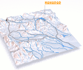 Places with similar names to Maharar, Yemen ::
Disclaimer :: Information on this page comes without warranty of any kind |
||
|
Where is Maharar? Elevation and coordinates ::
Latitude (lat): 13°39'0"N Longitude (lon): 44°43'0"E
Elevation (approx.): 1394m (map arrows pan, magnifying glasses zoom) |
||
|
Visiting Maharar? Hotel/Accommodation ::
Book a hotel in Maharar Travel Guide ::
Buy a travel guide for Yemen rental cars ::
car rental offers GPS waypoint ::
download a GPX waypoint (PoI) of Maharar for your GPS receiver
|
||