|
search place name
|
||
Maḩwī al ‘Abd (‘Adan, Yemen)Maḩwī al ‘Abd is a town in the ‘Adan region of Yemen. An overview map of the region around Maḩwī al ‘Abd is displayed below.
regional and 3d topo map of Maḩwī al ‘Abd, Yemen ::

Nearby towns ::
Al Muqbil (1.9km north) //
Qā‘ al Qulmah (1.9km south) //
Al Ḩāʼiţ (2.6km south east) //
Al Ḩāʼiţ (2.7km south west) //
Qaryat ash Shu‘ūb (3.7km west) //
Māshi‘ah (4.8km north west) //
Qaryat al Maḩwā (5.2km south east) //
Maḩall Shubayl (5.6km north west) //
Al Ḩab‘ī (5.7km south) //
Ḩays (5.7km south west) //
Qaryat al Ḩaraz (5.6km west) //
Al ‘Ukaysh (5.7km west) //
Al Bughayl (5.8km west) //
Bayt Baysh (6.1km west) //
Bayt ‘Ukaysh (6.7km west) //
Al Fashsh (6.9km south east) //
Al Kabbah al Ḩamrāʼ (6.9km north west) //
As Sab‘ah (7.1km south west) //
Al ‘Uqdah (7.3km south west) //
Bayt al Ḩaymī (7.4km west) //
Bayt Maghārī (7.5km south west) //
Nakhlah (7.7km south east) //
Ar Rāghah (7.7km north west) //
Al Ḩillah (7.7km west) //
Bayt al Bazāz (7.9km north west) //
‘Abādīyah ‘Ulyā (8.5km north) //
Bayt Bul‘ayd (8.5km north west) //
Al Marīr (8.4km east) //
As Suwaydirah (8.6km south) //
[all distances 'as the bird flies' and approximate] 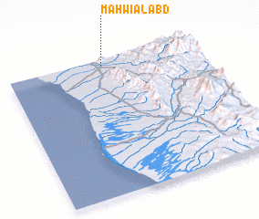 Places with similar names to Maḩwī al ‘Abd, Yemen :: Disclaimer :: Information on this page comes without warranty of any kind |
||
|
Where is Maḩwī al ‘Abd? Elevation and coordinates ::
Latitude (lat): 13°58'0"N Longitude (lon): 43°31'0"E
Elevation (approx.): 226m (map arrows pan, magnifying glasses zoom) |
||
|
Visiting Maḩwī al ‘Abd? Hotel/Accommodation ::
Book a hotel in Maḩwī al ‘Abd Travel Guide ::
Buy a travel guide for Yemen rental cars ::
car rental offers GPS waypoint ::
download a GPX waypoint (PoI) of Maḩwī al ‘Abd for your GPS receiver
|
||