|
search place name
|
||
Manşab (Abyan, Yemen)Manşab is a town in the Abyan region of Yemen. An overview map of the region around Manşab is displayed below.
regional and 3d topo map of Manşab, Yemen ::

Nearby towns ::
‘Awrumah (2.0km south) //
Al Qarn (2.8km south west) //
Umm Qanaila (2.9km north) //
Jiblat al Waznah (3.6km south) //
Al Maqbābah (3.7km west) //
Mūdiyah (3.8km west) //
Jiblat al Faraj (3.9km west) //
Umm Sha‘ra (4.6km north west) //
Umm Qulayţah (4.8km south east) //
Jirshab (5.2km south west) //
Dhawbah (5.3km south east) //
Na‘ab (5.3km south east) //
Umm Ḩasak (6.0km west) //
Umm Qaws (6.2km south east) //
Naq‘al (6.3km east) //
Umm Fara‘ (6.5km south east) //
Umm Qayf (6.5km south west) //
Umm Furayḑ (6.5km east) //
Far‘ān (6.7km south) //
Umm Hasif (6.9km west) //
Umm Jāyizah (6.9km west) //
Al Ḩabīl (7.1km west) //
Umm Madārah (7.4km south west) //
Umm Muḩafḩaf (7.4km south) //
Kawkab (7.7km east) //
‘Alī Hādī (8.4km south east) //
Al Ḩamām (8.6km south east) //
Maqāşir (8.6km south east) //
Al Qashabah (8.8km south west) //
[all distances 'as the bird flies' and approximate] 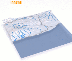 Places with similar names to Manşab, Yemen ::
Disclaimer :: Information on this page comes without warranty of any kind |
||
|
Where is Manşab? Elevation and coordinates ::
Latitude (lat): 13°56'4"N Longitude (lon): 46°7'5"E
Elevation (approx.): 832m (map arrows pan, magnifying glasses zoom) |
||
|
Visiting Manşab? Hotel/Accommodation ::
Book a hotel in Manşab Travel Guide ::
Buy a travel guide for Yemen rental cars ::
car rental offers GPS waypoint ::
download a GPX waypoint (PoI) of Manşab for your GPS receiver
|
||