|
search place name
|
||
Nafḩān (Al Ḩudaydah, Yemen)Nafḩān is a town in the Al Ḩudaydah region of Yemen. An overview map of the region around Nafḩān is displayed below.
regional and 3d topo map of Nafḩān, Yemen ::
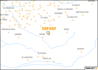
Nearby towns ::
Marba‘ (2.5km west) //
Yābis (2.9km north) //
Kufl (3.1km north east) //
Buyūt al ‘Ijālīyah (3.7km north) //
Al Kirnah (4.6km north west) //
Buyūt Umm Baba‘īyah (4.9km north) //
Dayr Umm Dubaysh (5.4km north) //
Al Qufl (5.5km north) //
Aţ Ţawr (5.7km north) //
Al Hajāmīyah (6.1km north) //
Al Jirbah (6.2km north) //
Gadia (6.7km east) //
Ad Dimnah (7.3km north) //
Al Qāḑiyah (7.3km north west) //
Ḩaraqah (8.0km north east) //
Aş Şa‘īd (8.1km north) //
Al Jabīl (8.4km north) //
An Naqībīyah (8.3km north west) //
Al Miqşal (8.6km south) //
Al Mahad (9.0km north west) //
Ḩasy al Maqbūlī (8.9km north west) //
Al Fuqayhīyah (9.1km north west) //
Arba‘īn (9.2km south west) //
Dayr ar Rayb (9.3km north west) //
Al Miqţar (10.2km north east) //
Umm Umayrīyah (10.3km north west) //
Şanīf ‘Abd Allāh ‘Umar (10.5km north west) //
Maḩall Saḩamah (10.7km north east) //
Buyūt ad Darāḩimah (10.8km north west) //
[all distances 'as the bird flies' and approximate] 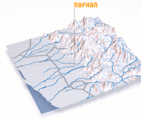 Places with similar names to Nafḩān, Yemen ::
// Nghĩa Hành (VN)
// Nafḩūn (YE)
Disclaimer :: Information on this page comes without warranty of any kind |
||
|
Where is Nafḩān? Elevation and coordinates ::
Latitude (lat): 14°28'27"N Longitude (lon): 43°29'19"E
Elevation (approx.): 265m (map arrows pan, magnifying glasses zoom) |
||
|
Visiting Nafḩān? Hotel/Accommodation ::
Book a hotel in Nafḩān Travel Guide ::
Buy a travel guide for Yemen rental cars ::
car rental offers GPS waypoint ::
download a GPX waypoint (PoI) of Nafḩān for your GPS receiver
|
||