|
search place name
|
||
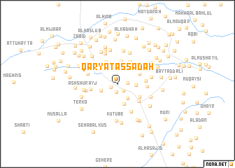
Qaryat as Sādah (Al Ḩudaydah, Yemen)Qaryat as Sādah is a town in the Al Ḩudaydah region of Yemen. An overview map of the region around Qaryat as Sādah is displayed below.
regional and 3d topo map of Qaryat as Sādah, Yemen ::
Nearby towns ::
At Turbah (1.2km south west) //
Janb al ‘Ayr (1.3km south) //
Bilād al Musāwāh (1.4km south east) //
Al Masāḩīb (1.6km east) //
Māti‘ (2.5km north) //
Bayt Quraybah (2.8km south east) //
Al Mukhayrīyān (2.8km south west) //
Al Jarrāḩī (2.9km east) //
Umm Qubayr (3.3km south) //
Maḩwá an Nāz̧ir (3.5km north) //
Al Mazra‘ (3.7km north) //
Al Ma‘āmirah (3.8km north east) //
Qaryat al Mazājīj (4.0km north west) //
Maḩwá as Sayyid (4.0km north east) //
Hadīmat Ma‘āşilah (4.0km south east) //
Maḩwá ‘Uqbān (4.2km west) //
Banī Shirayhid (4.3km south east) //
Al Jirb al Asfal (4.4km east) //
Qaryat al ‘Abīd (4.7km east) //
Ţurqūh (4.8km north west) //
Shi‘b al ‘Ukdah (4.9km south east) //
Bayt al Futt (4.9km west) //
Ash Shubayţāʼ (5.1km west) //
Al Ḩillah (5.3km north) //
Maḩwá al Hirrah (5.3km north) //
Az Zarībah (5.3km north) //
Kudayf (5.3km north west) //
Maḩwá ‘Aţīyah (5.5km north) //
Al ‘Arīsh (5.4km east) //
[all distances 'as the bird flies' and approximate]  Places with similar names to Qaryat as Sādah, Yemen ::
Disclaimer :: Information on this page comes without warranty of any kind |
||
|
Where is Qaryat as Sādah? Elevation and coordinates ::
Latitude (lat): 14°8'8"N Longitude (lon): 43°22'5"E
Elevation (approx.): 142m (map arrows pan, magnifying glasses zoom) |
||
|
Visiting Qaryat as Sādah? Hotel/Accommodation ::
Book a hotel in Qaryat as Sādah Travel Guide ::
Buy a travel guide for Yemen rental cars ::
car rental offers GPS waypoint ::
download a GPX waypoint (PoI) of Qaryat as Sādah for your GPS receiver
|
||