|
search place name
|
||
Sūq ar Ribāţ (‘Adan, Yemen)Sūq ar Ribāţ is a town in the ‘Adan region of Yemen. An overview map of the region around Sūq ar Ribāţ is displayed below.
regional and 3d topo map of Sūq ar Ribāţ, Yemen ::

Nearby towns ::
Al Quş‘ah (1.5km east) //
Kitf (4.2km north) //
Al Midman (4.9km west) //
Nawmah (5.6km north) //
Kubbat ash Shāwish (5.8km west) //
Kabbat ash Shāwīsh (5.8km west) //
Al Jabīn (5.9km north east) //
Manārah (6.1km south east) //
Al Jaby (6.2km north east) //
Maḩall Ghurāfāt (6.5km north) //
Maḩall Sufākah (6.7km south west) //
Janbat ash Sharīf (6.9km south) //
Maţāḩin (7.0km north east) //
Al ‘Urs (7.1km south) //
Kusmah (7.3km south east) //
Maḩall Kuḩayl (7.6km north west) //
Ar Ramād (8.1km south west) //
Bulaybilah (8.4km west) //
Kistah (8.9km south) //
Al ‘Āriḑ (8.9km south west) //
Maḩall Khābiyah (9.2km south) //
Aluja (9.5km south west) //
Al Ḩanashīyah (9.5km south west) //
Khadd al Kalb (10.6km south west) //
[all distances 'as the bird flies' and approximate] 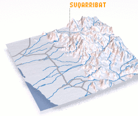 Places with similar names to Sūq ar Ribāţ, Yemen ::
// Şǝkǝrabad (AZ)
// Scherbda (DE)
// Zgura Băiţa (RO)
// Sukrābād (BD)
// Sukrābād (BD)
// Sekarābād (IR)
// Zākirābād (PK)
// Z̄ekrābād (IR)
// Square Butte (US)
// Scarbotte (BE)
Disclaimer :: Information on this page comes without warranty of any kind |
||
|
Where is Sūq ar Ribāţ? Elevation and coordinates ::
Latitude (lat): 14°40'43"N Longitude (lon): 43°33'4"E
Elevation (approx.): 605m (map arrows pan, magnifying glasses zoom) |
||
|
Visiting Sūq ar Ribāţ? Hotel/Accommodation ::
Book a hotel in Sūq ar Ribāţ Travel Guide ::
Buy a travel guide for Yemen rental cars ::
car rental offers GPS waypoint ::
download a GPX waypoint (PoI) of Sūq ar Ribāţ for your GPS receiver
|
||