|
search place name
|
||
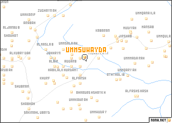
Umm Suwaydāʼ (Abyan, Yemen)Umm Suwaydāʼ is a town in the Abyan region of Yemen. An overview map of the region around Umm Suwaydāʼ is displayed below.
regional and 3d topo map of Umm Suwaydāʼ, Yemen ::
Nearby towns ::
Shabāh (1.5km north west) //
Nawbat al Yazīdī (1.5km north west) //
Ad Dakhlah (1.5km north west) //
An Nawbah (1.5km north west) //
Tanawwukh (1.7km south west) //
Thuwayrayn (2.8km east) //
Al Qā‘ (3.2km south west) //
Biʼr an Nakha‘īn (3.2km west) //
Ad Darb (3.2km west) //
Umm Maş‘ām (3.3km north west) //
Umm Şala‘ah (4.6km north west) //
Al Farsh (5.0km south) //
‘Adan (5.0km west) //
Maḩrab (5.0km west) //
Umm Khudayrah (5.3km south west) //
Al Ḩāfah (5.5km north west) //
Ḩabīl al Khurdamī (5.7km south west) //
Makrārah (5.9km south west) //
Al Qashabah (6.0km north east) //
Umm Qīfirīyah (6.1km west) //
Kabarān (6.8km north east) //
Jaḩḩayn (6.7km west) //
Al Biʼr (6.7km west) //
Al Kharabīyah (7.3km south west) //
Umm Nawbah (7.5km west) //
Ath Thalib (7.6km south east) //
Aḩmad ash Shaykh (8.0km south) //
Umm Jāyizah (8.0km north east) //
Sākin Ahl Sādah (8.0km south west) //
[all distances 'as the bird flies' and approximate]  Places with similar names to Umm Suwaydāʼ, Yemen ::
// Umm Sawād (YE)
Disclaimer :: Information on this page comes without warranty of any kind |
||
|
Where is Umm Suwaydāʼ? Elevation and coordinates ::
Latitude (lat): 13°52'35"N Longitude (lon): 45°59'42"E
Elevation (approx.): 852m (map arrows pan, magnifying glasses zoom) |
||
|
Visiting Umm Suwaydāʼ? Hotel/Accommodation ::
Book a hotel in Umm Suwaydāʼ Travel Guide ::
Buy a travel guide for Yemen rental cars ::
car rental offers GPS waypoint ::
download a GPX waypoint (PoI) of Umm Suwaydāʼ for your GPS receiver
|
||