|
search place name
|
||
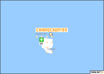
Chiang-chün-yen (T'ai-wan, Taiwan)Chiang-chün-yen is a town in the T'ai-wan region of Taiwan. An overview map of the region around Chiang-chün-yen is displayed below.
regional and 3d topo map of Chiang-chün-yen, Taiwan ::
Chiang-chün-yen airports ::
The nearest airport is GNI - Green Island Lyudao, located 3.6 km west of Chiang-chün-yen.
Other airports nearby include TTT - Fengnin (41.7 km west), KYD - Lanyu (72.6 km south), PIF - Pingtung South (106.7 km west), KHH - Kaohsiung Intl (118.8 km west), Nearby towns ::
Liu-ma-kou (0.0km north) //
Lan-tzu-hu (0.0km north) //
Yu-tzu-hu (1.9km south) //
Kung-kuan (1.7km west) //
Lü-tao-hsiang (2.5km south west) //
Pai-kang (2.5km south west) //
Kuan-yin-tung (2.5km south west) //
Ch'ai-k'ou (3.4km west) //
Chung-liao (3.4km west) //
Yü-kang (3.9km south west) //
Nan-liao (3.9km south west) //
Hai-shen-p'ing (4.1km south west) //
Pi-t'ou-chiao (5.1km west) //
Tso-p'ing (5.6km south) //
Pai-sha-wei (5.8km south) //
[all distances 'as the bird flies' and approximate] 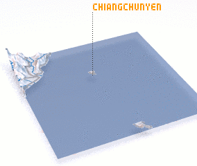 Places with similar names to Chiang-chün-yen, Taiwan ::
// Changshanyuan (CN)
// Changshanyan (CN)
Disclaimer :: Information on this page comes without warranty of any kind |
||
|
Where is Chiang-chün-yen? Elevation and coordinates ::
Latitude (lat): 22°41'0"N Longitude (lon): 121°30'0"E
Elevation (approx.): -32768m (map arrows pan, magnifying glasses zoom) |
||
|
Visiting Chiang-chün-yen? Hotel/Accommodation ::
Book a hotel in Chiang-chün-yen Travel Guide ::
Buy a travel guide for Taiwan rental cars ::
car rental offers GPS waypoint ::
download a GPX waypoint (PoI) of Chiang-chün-yen for your GPS receiver
|
||