|
search place name
|
||
Fen-ch'ang (T'ai-wan, Taiwan)Fen-ch'ang is a town in the T'ai-wan region of Taiwan. An overview map of the region around Fen-ch'ang is displayed below.
regional and 3d topo map of Fen-ch'ang, Taiwan ::

Fen-ch'ang airports ::
The nearest airport is HUN - Hualien, located 67.6 km east of Fen-ch'ang.
Other airports nearby include TPE - Taipei Chiang Kai Shek Intl (94.7 km north), TSA - Taipei Sungshan (106.6 km north east), CYI - Chiayi (107.0 km south west), MZG - Makung Magong (158.7 km south west), Nearby towns ::
Hsiao-hsüeh-shan-lin-pan (4.1km north east) //
Ku-kuan (5.6km south) //
Hsia-ku-kuan (5.6km south) //
Ha-lung-t'ai (5.8km south) //
Chung-hsüeh-shan-lin-pan (6.3km north east) //
Ma-lun (6.3km south east) //
Hsin-shan (6.5km south east) //
Chia-pao-t'ai (7.4km south) //
Li-yang (7.6km south) //
Po-ai-ts'un (7.6km south) //
Sung-ho (8.1km south west) //
Chiu-liang-hsi (8.1km south west) //
Wu-shih-k'eng (8.5km north west) //
[all distances 'as the bird flies' and approximate] 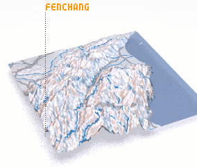 Places with similar names to Fen-ch'ang, Taiwan ::
// Vanchenki (RU)
// Vancheng (IN)
// Fanchiniko (GH)
// Van Chàng (VN)
// Vẩn Chàng (VN)
// Van Chung (VN)
// Văn Chương (VN)
// Fanchang (CN)
// Fancheng (CN)
// Fanchong (CN)
Disclaimer :: Information on this page comes without warranty of any kind |
||
|
Where is Fen-ch'ang? Elevation and coordinates ::
Latitude (lat): 24°15'0"N Longitude (lon): 121°0'0"E
Elevation (approx.): 1789m (map arrows pan, magnifying glasses zoom) |
||
|
Visiting Fen-ch'ang? Hotel/Accommodation ::
Book a hotel in Fen-ch'ang Travel Guide ::
Buy a travel guide for Taiwan rental cars ::
car rental offers GPS waypoint ::
download a GPX waypoint (PoI) of Fen-ch'ang for your GPS receiver
|
||