|
search place name
|
||
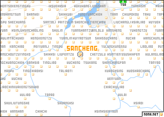
San-ch'eng (T'ai-wan, Taiwan)San-ch'eng is a town in the T'ai-wan region of Taiwan. An overview map of the region around San-ch'eng is displayed below.
regional and 3d topo map of San-ch'eng, Taiwan ::
San-ch'eng airports ::
The nearest airport is TSA - Taipei Sungshan, located 15.8 km north east of San-ch'eng.
Other airports nearby include TPE - Taipei Chiang Kai Shek Intl (27.5 km north west), HUN - Hualien (103.8 km south), OGN - Yonaguni Jima Yonaguni (162.0 km east), CYI - Chiayi (197.7 km south west), Nearby towns ::
Shuang-ch'eng-li (0.0km north) //
An-k'eng (0.0km north) //
T'ou-ch'eng (1.7km east) //
Erh-ch'eng (1.7km east) //
Nei-t'eng-liao-k'eng (1.9km north) //
Nan-she-k'o (1.7km west) //
Ts'u-k'ang (2.5km south east) //
Ta-mao-pu (2.5km north east) //
Hsiao-ts'u-k'eng (2.5km north east) //
Wu-ch'eng (2.5km south west) //
Ch'ing-hua (2.5km north west) //
Ch'e-tzu-lu (3.4km east) //
T'ing-liao-ts'un (3.7km north) //
Hui-yao-ts'un (3.7km north) //
Liu-fen-tzu (3.4km west) //
Ta-k'eng (3.4km west) //
Nei-ma-tsu-t'ine (3.4km west) //
Chung-k'eng (4.1km north east) //
Heng-lu (4.1km north east) //
Shih-ssu-fen-lu (3.8km north east) //
An-k'eng (3.8km north east) //
Chu-tu-shan (3.8km north east) //
Kan-lin (4.1km north west) //
Ch'ing-shui-k'eng (4.1km north west) //
Nei-kan-lin (4.1km north west) //
An-k'eng-li (3.8km south west) //
Ta-ch'iu-yüan (3.8km north west) //
P'i-t'ang (3.8km north west) //
Heng-lu (5.0km north east) //
[all distances 'as the bird flies' and approximate] 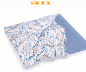 Places with similar names to San-ch'eng, Taiwan ::
Disclaimer :: Information on this page comes without warranty of any kind |
||
|
Where is San-ch'eng? Elevation and coordinates ::
Latitude (lat): 24°57'0"N Longitude (lon): 121°28'0"E
Elevation (approx.): 332m (map arrows pan, magnifying glasses zoom) |
||
|
Visiting San-ch'eng? Hotel/Accommodation ::
Book a hotel in San-ch'eng Travel Guide ::
Buy a travel guide for Taiwan rental cars ::
car rental offers GPS waypoint ::
download a GPX waypoint (PoI) of San-ch'eng for your GPS receiver
|
||