|
search place name
|
||
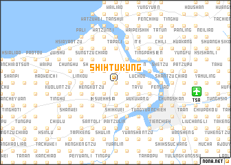
Shih-t'u-kung (T'ai-wan, Taiwan)Shih-t'u-kung is a town in the T'ai-wan region of Taiwan. An overview map of the region around Shih-t'u-kung is displayed below.
regional and 3d topo map of Shih-t'u-kung, Taiwan ::
Shih-t'u-kung airports ::
The nearest airport is TSA - Taipei Sungshan, located 12.1 km east of Shih-t'u-kung.
Other airports nearby include TPE - Taipei Chiang Kai Shek Intl (20.2 km west), HUN - Hualien (118.9 km south), OGN - Yonaguni Jima Yonaguni (170.5 km south east), MZW - Matsu Beigan (191.3 km north west), Nearby towns ::
Wu-ku (0.0km north) //
Feng-shu-chiao (1.9km south) //
Ta-k'o-k'ou (1.9km south) //
Wu-ku-k'eng (1.7km west) //
Wai-liao (1.7km west) //
Nan-kang-tzu (1.7km east) //
Chu-hua (1.7km east) //
Ch'eng-chou (1.9km north) //
Chung-lu (1.7km east) //
Chi-fu-ts'un (1.9km north) //
Keng-liao (1.7km east) //
Pan-shan-tzu (2.5km south west) //
Li-t'ou-k'o (2.5km south west) //
T'ai-shan (2.5km south west) //
Kan-ch'eng-san-ts'un (2.5km south west) //
T'ai-mao-erh-ts'un (2.5km south east) //
Chiu-wen (2.5km south east) //
Hsin-wen (2.5km south east) //
Leng-shui-k'eng (2.5km north west) //
Li-kuang-i-ts'un (2.5km north west) //
Kuan-yin (2.5km north west) //
Ch'eng-tzu-liao (2.5km north east) //
Cheng-i-ts'un (2.5km north east) //
Chou-hou (2.5km north east) //
Shih-tzu-t'ou (2.5km north east) //
Lung-kou-k'eng (3.4km west) //
Tung-lin-ts'un (3.4km west) //
T'ien-hsin-tzu (3.7km south) //
Lu-chou (3.4km east) //
[all distances 'as the bird flies' and approximate]  Places with similar names to Shih-t'u-kung, Taiwan ::
// Shatahkung (MM)
// Chittagong (BD)
// Châtignac (FR)
// Hsia-ta-k'eng (TW)
// Shih-t'i-k'eng (TW)
// Ch'ai-t'ou-kang (TW)
// Shih-t'ou-k'eng (TW)
// Shih-t'ou-k'eng (TW)
// Shidaqing (CN)
// Shitougang (CN)
Disclaimer :: Information on this page comes without warranty of any kind |
||
|
Where is Shih-t'u-kung? Elevation and coordinates ::
Latitude (lat): 25°5'0"N Longitude (lon): 121°26'0"E
Elevation (approx.): 66m (map arrows pan, magnifying glasses zoom) |
||
|
Visiting Shih-t'u-kung? Hotel/Accommodation ::
Book a hotel in Shih-t'u-kung Travel Guide ::
Buy a travel guide for Taiwan rental cars ::
car rental offers GPS waypoint ::
download a GPX waypoint (PoI) of Shih-t'u-kung for your GPS receiver
|
||