|
search place name
|
||
Bratotin (Srbija, Serbia and Montenegro)Bratotin is a town in the Srbija region of Serbia and Montenegro. An overview map of the region around Bratotin is displayed below.
regional and 3d topo map of Bratotin, Serbia and Montenegro ::

Bratotin airports ::
The nearest airport is PRN - Pristina, located 40.9 km north east of Bratotin.
Other airports nearby include SKP - Skopje (100.3 km south east), TGD - Podgorica (109.6 km west), TIA - Tirana Rinas (132.9 km south west), OHD - Ohrid (138.9 km south), Nearby towns ::
Vranjak (1.2km south west) //
Bobovac (1.8km north west) //
Našpale (2.3km south east) //
Sanovac (2.9km north east) //
Pusto Selo (3.2km north) //
Poluža (3.2km north west) //
Drenovac (2.9km north east) //
Sopnić (4.7km south) //
Donje Potočane (4.3km south east) //
Ratkovac (3.7km south west) //
Gornje Potočane (3.8km south east) //
Danjane (3.6km west) //
Potok (4.9km north) //
Dobridol (4.1km north west) //
Koznik (5.5km north) //
Saros (4.7km north west) //
Petković (5.7km north) //
Zatrić (5.2km north east) //
Radoste (5.5km south west) //
Brnjača (7.1km south east) //
Čiflak (6.2km north west) //
Geđe (7.3km south west) //
Bela Crkva (7.7km south) //
Zrze (8.4km south) //
Doblibare (6.4km west) //
Bardosan (6.6km west) //
Orahovac (6.8km south east) //
Labučevo (8.9km north) //
Kramovik (7.9km north west) //
[all distances 'as the bird flies' and approximate] 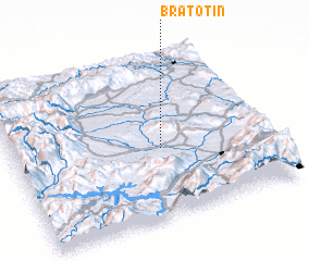 Places with similar names to Bratotin, Serbia and Montenegro ::
Disclaimer :: Information on this page comes without warranty of any kind |
||
|
Where is Bratotin? Elevation and coordinates ::
Latitude (lat): 42°25'30"N Longitude (lon): 20°34'47"E
Elevation (approx.): 387m (map arrows pan, magnifying glasses zoom) |
||
|
Visiting Bratotin? Hotel/Accommodation ::
Book a hotel in Bratotin Travel Guide ::
rental cars ::
car rental offers GPS waypoint ::
download a GPX waypoint (PoI) of Bratotin for your GPS receiver
|
||