|
search place name
|
||
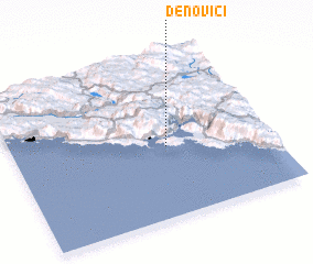
Ðenovići (Crna Gora, Serbia and Montenegro)Ðenovići is a town in the Crna Gora region of Serbia and Montenegro. An overview map of the region around Ðenovići is displayed below.
regional and 3d topo map of Ðenovići, Serbia and Montenegro ::

Ðenovići airports ::
The nearest airport is TIV - Tivat, located 10.6 km east of Ðenovići.
Other airports nearby include DBV - Dubrovnik (30.7 km north west), TGD - Podgorica (54.2 km east), OMO - Mostar (112.5 km north west), TIA - Tirana Rinas (146.6 km south east), Nearby towns ::
Pristan (1.3km south) //
Kumbor (1.4km west) //
Miočevići (1.5km north west) //
Trojanovići (1.8km south) //
Mitrovići (1.9km south) //
Obalice (2.0km north) //
Zabrđe (2.1km south) //
Stojkovići (2.0km south west) //
Rujevo (2.5km north) //
Mandegaj (2.3km south west) //
Ivovići (2.3km north east) //
Glogovik (2.8km north) //
Zmijice (2.2km north west) //
Pestorići (2.9km north) //
Spilice (2.2km west) //
Kuti (2.8km north west) //
Baošići (2.4km east) //
Zelenika (2.6km north west) //
Zaušje (2.6km north east) //
Kuti (3.3km north west) //
Marići (3.4km north west) //
Repaji (3.7km north) //
Eraci (3.8km south) //
Tići (3.6km south west) //
Mrkovi (3.4km south west) //
Nakičenovići (3.6km north west) //
Babunci (4.1km south) //
Radovanići (4.2km south) //
Večerići (3.7km south west) //
[all distances 'as the bird flies' and approximate]  Places with similar names to Ðenovići, Serbia and Montenegro ::
Disclaimer :: Information on this page comes without warranty of any kind |
||
|
Where is Ðenovići? Elevation and coordinates ::
Latitude (lat): 42°26'13"N Longitude (lon): 18°36'8"E
Elevation (approx.): 14m (map arrows pan, magnifying glasses zoom) |
||
|
Visiting Ðenovići? Hotel/Accommodation ::
Book a hotel in Ðenovići Travel Guide ::
rental cars ::
car rental offers GPS waypoint ::
download a GPX waypoint (PoI) of Ðenovići for your GPS receiver
|
||