|
search place name
|
||
Kamik (Srbija, Serbia and Montenegro)Kamik is a town in the Srbija region of Serbia and Montenegro. An overview map of the region around Kamik is displayed below.
regional and 3d topo map of Kamik, Serbia and Montenegro ::

Kamik airports ::
The nearest airport is INI - Nis, located 65.8 km north west of Kamik.
Other airports nearby include SOF - Sofia (79.5 km south east), PRN - Pristina (136.4 km south west), SKP - Skopje (144.5 km south west), CRA - Craiova (175.9 km north east), Nearby towns ::
Prisjan (2.5km north) //
Berovica (3.1km south) //
Carev Del (5.1km south) //
Sinja Glava (4.2km west) //
Petrovac (4.6km north east) //
Držina (5.5km north east) //
Vojnegovac (5.6km east) //
Jalbotina (5.8km south east) //
Rasnica (7.3km north west) //
Pasjač (6.1km north west) //
Kusa Vrana (8.9km south) //
Sukovo (6.6km east) //
Kijevac (7.3km south west) //
Poljska Ržana (8.9km north east) //
Vlasi (8.5km south east) //
Valniš (10.2km south west) //
[all distances 'as the bird flies' and approximate] 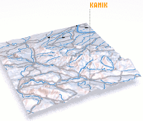 Places with similar names to Kamik, Serbia and Montenegro ::
Disclaimer :: Information on this page comes without warranty of any kind |
||
|
Where is Kamik? Elevation and coordinates ::
Latitude (lat): 43°3'28"N Longitude (lon): 22°34'4"E
Elevation (approx.): 636m (map arrows pan, magnifying glasses zoom) |
||
|
Visiting Kamik? Hotel/Accommodation ::
Book a hotel in Kamik Travel Guide ::
rental cars ::
car rental offers GPS waypoint ::
download a GPX waypoint (PoI) of Kamik for your GPS receiver
|
||