|
search place name
|
||
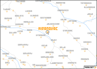
Miranovac (Srbija, Serbia and Montenegro)Miranovac is a town in the Srbija region of Serbia and Montenegro. An overview map of the region around Miranovac is displayed below.
regional and 3d topo map of Miranovac, Serbia and Montenegro ::
Miranovac airports ::
The nearest airport is INI - Nis, located 42.2 km west of Miranovac.
Other airports nearby include SOF - Sofia (112.3 km south east), PRN - Pristina (140.1 km south west), CRA - Craiova (161.5 km north east), SKP - Skopje (167.5 km south), Nearby towns ::
Vitanovac (2.4km south west) //
Pajež (3.3km south east) //
Jalovik Izvor (3.6km north east) //
Kozja (5.2km south) //
Šesti Gabar (5.8km north) //
Periš (5.3km west) //
Stanjinac (5.5km east) //
Kalna (6.6km north east) //
Babin Kal (7.7km south) //
Orlja (7.1km south east) //
Vlahovo (7.6km north west) //
Manojlica (6.9km north west) //
Inovo (7.5km north east) //
Gabrovnica (9.5km north east) //
Bazovik (9.4km south east) //
Lukovo (10.0km north west) //
Donji Rinj (10.0km south west) //
[all distances 'as the bird flies' and approximate]  Places with similar names to Miranovac, Serbia and Montenegro ::
Disclaimer :: Information on this page comes without warranty of any kind |
||
|
Where is Miranovac? Elevation and coordinates ::
Latitude (lat): 43°21'50"N Longitude (lon): 22°22'24"E
Elevation (approx.): 672m (map arrows pan, magnifying glasses zoom) |
||
|
Visiting Miranovac? Hotel/Accommodation ::
Book a hotel in Miranovac Travel Guide ::
rental cars ::
car rental offers GPS waypoint ::
download a GPX waypoint (PoI) of Miranovac for your GPS receiver
|
||