|
search place name
|
||
Zasad (Srbija, Serbia and Montenegro)Zasad is a town in the Srbija region of Serbia and Montenegro. An overview map of the region around Zasad is displayed below.
regional and 3d topo map of Zasad, Serbia and Montenegro ::

Zasad airports ::
The nearest airport is INI - Nis, located 108.2 km east of Zasad.
Other airports nearby include PRN - Pristina (110.5 km south), BEG - Beograd (147.9 km north), TGD - Podgorica (164.2 km south west), TIV - Tivat (191.3 km south west), Nearby towns ::
Batina (0.8km south east) //
Selište (2.3km north west) //
Beli Potok (2.1km south west) //
Dolevi (1.9km west) //
Obarak (2.7km south) //
Borovci (2.4km south east) //
Barice (3.2km north west) //
Dolac (3.4km south west) //
Ðakovo (3.4km north west) //
Godović (3.1km south west) //
Leskovica (3.0km west) //
Vranjevo (4.0km south) //
Brezova (3.0km west) //
Lipovac (4.4km south) //
Borika (3.2km west) //
Prčani (4.4km south) //
Kamenjani (4.3km south east) //
Vrh (4.6km south west) //
Kosurići (5.1km south) //
Pačavrići (4.8km north west) //
Odmejie (4.0km east) //
Brezova (4.3km north west) //
Božići (5.6km south west) //
Belobraće (5.4km south east) //
Dojovi (5.2km north east) //
Reka (6.0km south) //
Zeleznica (6.5km south) //
Kralji (6.4km south) //
Slatina (7.0km south) //
[all distances 'as the bird flies' and approximate] 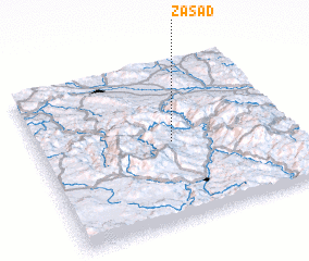 Places with similar names to Zasad, Serbia and Montenegro ::
Disclaimer :: Information on this page comes without warranty of any kind |
||
|
Where is Zasad? Elevation and coordinates ::
Latitude (lat): 43°29'50"N Longitude (lon): 20°32'10"E
Elevation (approx.): 659m (map arrows pan, magnifying glasses zoom) |
||
|
Visiting Zasad? Hotel/Accommodation ::
Book a hotel in Zasad Travel Guide ::
rental cars ::
car rental offers GPS waypoint ::
download a GPX waypoint (PoI) of Zasad for your GPS receiver
|
||