|
search place name
|
||
Agadir (Marrakech, Morocco)Agadir is a town in the Marrakech region of Morocco. An overview map of the region around Agadir is displayed below.
regional and 3d topo map of Agadir, Morocco ::

Agadir airports ::
The nearest airport is RAK - Marrakech Menara, located 96.1 km north east of Agadir.
Other airports nearby include AGA - Agadir Inezgane (102.6 km south west), OZZ - Ouarzazate (172.7 km east), Nearby towns ::
Irhilene (0.0km north) //
Sidi Amr Ou Haddou (1.9km south) //
Aït Ba Hammou (1.9km south) //
Afensou (2.4km south west) //
Tasseli (3.7km north) //
Oussikis (4.0km north west) //
Mtili (3.7km south west) //
Ouzagas (4.0km south west) //
Assif Lalou (4.9km south east) //
Tinelrat (4.9km south east) //
Amesdat (4.9km south east) //
Ouaounsaout (5.8km south) //
Anchkrir (5.8km north) //
Targa Oufella (5.1km east) //
Allous (5.1km east) //
Tassa (5.1km west) //
Aguersili (6.4km north west) //
Talmodat (6.4km north east) //
Ighilman (7.3km south east) //
Tannesmekht (8.1km north east) //
Tizza (7.4km south west) //
Aït Mhand (8.8km north west) //
[all distances 'as the bird flies' and approximate] 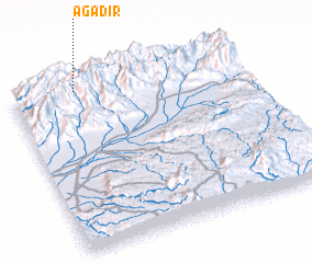 Places with similar names to Agadir, Morocco ::
Disclaimer :: Information on this page comes without warranty of any kind |
||
|
Where is Agadir? Elevation and coordinates ::
Latitude (lat): 30°58'0"N Longitude (lon): 8°43'0"W
Elevation (approx.): 2073m (map arrows pan, magnifying glasses zoom) |
||
|
Visiting Agadir? Hotel/Accommodation ::
Book a hotel in Agadir Travel Guide ::
Buy a travel guide for Morocco rental cars ::
car rental offers GPS waypoint ::
download a GPX waypoint (PoI) of Agadir for your GPS receiver
|
||