|
search place name
|
||
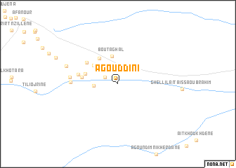
Agouddini (Ouarzazate, Morocco)Agouddini is a town in the Ouarzazate region of Morocco. An overview map of the region around Agouddini is displayed below.
regional and 3d topo map of Agouddini, Morocco ::
Agouddini airports ::
The nearest airport is ERH - Er-rachidia Moulay Ali Cherif, located 110.2 km north east of Agouddini.
Other airports nearby include OZZ - Ouarzazate (154.4 km west), Nearby towns ::
Tabesbess (1.1km north) //
Tarhzout nʼAït Yazza (2.1km north west) //
Ghellil Aït Isfoul (3.5km north east) //
Tadafalt (3.3km west) //
Bou Taghal (4.5km north) //
Irhem Akdim (4.5km north west) //
Tloult (4.8km north west) //
El Hart nʼIgourramene (4.7km west) //
Achdad (5.0km west) //
Aït el Meskine (5.5km north west) //
El Hart nʼIamine (5.6km west) //
Taghia (6.4km west) //
Tisgua (6.6km west) //
Aït Hammi (6.6km west) //
Aït Yalla (7.6km west) //
[all distances 'as the bird flies' and approximate]  Places with similar names to Agouddini, Morocco ::
Disclaimer :: Information on this page comes without warranty of any kind |
||
|
Where is Agouddini? Elevation and coordinates ::
Latitude (lat): 31°26'24"N Longitude (lon): 5°23'54"W
Elevation (approx.): 1166m (map arrows pan, magnifying glasses zoom) |
||
|
Visiting Agouddini? Hotel/Accommodation ::
Book a hotel in Agouddini Travel Guide ::
Buy a travel guide for Morocco rental cars ::
car rental offers GPS waypoint ::
download a GPX waypoint (PoI) of Agouddini for your GPS receiver
|
||