|
search place name
|
||
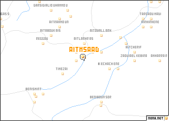
Aït mʼSâad (Taza, Morocco)Aït mʼSâad is a town in the Taza region of Morocco. An overview map of the region around Aït mʼSâad is displayed below.
regional and 3d topo map of Aït mʼSâad, Morocco ::
Aït mʼSâad airports ::
The nearest airport is FEZ - Fez Saiss, located 101.0 km west of Aït mʼSâad.
Other airports nearby include MEK - Meknes Bassatine (149.1 km west), AHU - Al Hociema Cherif El Idrissi (162.2 km north), MLN - Melilla (194.5 km north east), ERH - Er-rachidia Moulay Ali Cherif (201.3 km south), Nearby towns ::
Tighza (0.6km north) //
Tibouda (1.5km west) //
Imezlaï (2.4km north west) //
Igli (2.4km north east) //
Aït Larhras (3.7km north) //
Arhem Ifounassene (3.6km north east) //
Timezaï (5.0km south west) //
Ikechachene (5.0km east) //
Aït Ouallarh (6.4km north east) //
Tagdimt (6.4km east) //
Aït Aboukaïs (8.3km north west) //
Aït Rahmoun (8.7km north west) //
Berkine (8.4km north east) //
[all distances 'as the bird flies' and approximate] 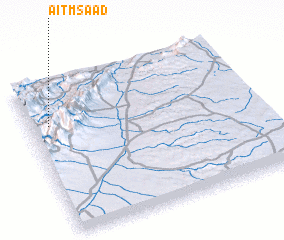 Places with similar names to Aït mʼSâad, Morocco ::
// Adămeşti (RO)
// Adămeşti (RO)
// Adum East (NG)
// Aït Messaoud (MA)
// Aït Messaoud (MA)
// Aït Messaoud (MA)
// Aït Messaoud (MA)
// Aït Messaoud (MA)
// Aït Moussa Addi (MA)
// Aït-Messaoud (MA)
Disclaimer :: Information on this page comes without warranty of any kind |
||
|
Where is Aït mʼSâad? Elevation and coordinates ::
Latitude (lat): 33°43'0"N Longitude (lon): 3°55'0"W
Elevation (approx.): 1252m (map arrows pan, magnifying glasses zoom) |
||
|
Visiting Aït mʼSâad? Hotel/Accommodation ::
Book a hotel in Aït mʼSâad Travel Guide ::
Buy a travel guide for Morocco rental cars ::
car rental offers GPS waypoint ::
download a GPX waypoint (PoI) of Aït mʼSâad for your GPS receiver
|
||