|
search place name
|
||
Aït Souss (Ouarzazate, Morocco)Aït Souss is a town in the Ouarzazate region of Morocco. An overview map of the region around Aït Souss is displayed below.
regional and 3d topo map of Aït Souss, Morocco ::

Aït Souss airports ::
The nearest airport is OZZ - Ouarzazate, located 35.9 km south west of Aït Souss.
Other airports nearby include RAK - Marrakech Menara (149.2 km north west), Nearby towns ::
Oulad Brahim (0.0km north) //
Tajnat (1.6km east) //
Tiligiout (1.6km east) //
Aït Allah Ben Yahya (1.9km south) //
Zouiyya (2.0km south) //
Mrhija (2.4km south east) //
Lhasoun (2.4km south west) //
Oulad Ali (2.6km south east) //
Ouled Menea (3.7km south) //
Makhamane (3.7km south) //
Oulad Amirat (3.7km south) //
Oulad Saïd (4.0km south east) //
Aït Saïd (4.9km north west) //
Zouiat Madri (4.7km west) //
Skoura (5.2km south east) //
Taskoukamt (5.6km south) //
Magramane (5.6km south) //
Oulad Ammar (4.9km west) //
Aït Oumzar (5.1km west) //
Laarbia (5.8km south) //
Rhamadane (5.8km south) //
Timinit (5.1km west) //
Oulad ʼArbiya (6.3km south) //
Aït Saïd Ou Mansour (5.8km north west) //
Zgassif (7.4km south) //
Ouled el Hajj (7.6km south) //
Gaddara (8.9km south) //
[all distances 'as the bird flies' and approximate] 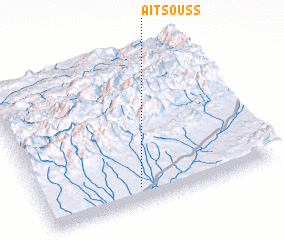 Places with similar names to Aït Souss, Morocco ::
Disclaimer :: Information on this page comes without warranty of any kind |
||
|
Where is Aït Souss? Elevation and coordinates ::
Latitude (lat): 31°6'0"N Longitude (lon): 6°35'0"W
Elevation (approx.): 1259m (map arrows pan, magnifying glasses zoom) |
||
|
Visiting Aït Souss? Hotel/Accommodation ::
Book a hotel in Aït Souss Travel Guide ::
Buy a travel guide for Morocco rental cars ::
car rental offers GPS waypoint ::
download a GPX waypoint (PoI) of Aït Souss for your GPS receiver
|
||