|
search place name
|
||
Altaïn (Tiznit, Morocco)Altaïn is a town in the Tiznit region of Morocco. An overview map of the region around Altaïn is displayed below.
regional and 3d topo map of Altaïn, Morocco ::

Altaïn airports ::
The nearest airport is TTA - Tan Tan Plage Blanche, located 115.8 km south west of Altaïn.
Other airports nearby include AGA - Agadir Inezgane (153.1 km north east), Nearby towns ::
Dar Tasila (1.9km north) //
Oukris (1.9km north) //
Boused (1.6km east) //
Sidi Embark (1.6km west) //
Esmahara (1.6km east) //
Sidi Hibba (1.9km south) //
Bou Fares (2.5km north east) //
Dar el Haithat (2.5km north west) //
Id Fares (2.5km north east) //
Alhehi (2.5km north west) //
Dar Id Boused (3.7km north) //
Sidi Belaïd (3.2km east) //
Aït Slimane (3.2km east) //
Aguechgal (3.7km north east) //
Sidi Mohammed Gout (3.7km south east) //
Sidi Brahim (4.9km east) //
Sidi Ali Jama (5.2km west) //
Aguejsal (5.2km east) //
Houafi (5.2km east) //
Tilisas (5.2km east) //
Assouakine (5.8km south) //
El Hocaïba (5.8km north) //
Aït Heraïbsa (6.1km north east) //
Embark U Mulud (6.4km north east) //
Bel Haders (6.4km north east) //
Agroun Moblar (6.5km east) //
Tikensar (6.7km east) //
Lasdar (6.7km east) //
Sidi Mansour (6.7km east) //
[all distances 'as the bird flies' and approximate] 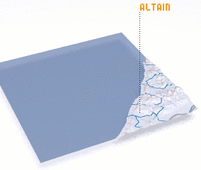 Places with similar names to Altaïn, Morocco ::
Disclaimer :: Information on this page comes without warranty of any kind |
||
|
Where is Altaïn? Elevation and coordinates ::
Latitude (lat): 29°10'0"N Longitude (lon): 10°18'0"W
Elevation (approx.): 330m (map arrows pan, magnifying glasses zoom) |
||
|
Visiting Altaïn? Hotel/Accommodation ::
Book a hotel in Altaïn Travel Guide ::
Buy a travel guide for Morocco rental cars ::
car rental offers GPS waypoint ::
download a GPX waypoint (PoI) of Altaïn for your GPS receiver
|
||