|
search place name
|
||
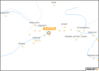
Aoudim (Er Rachidia, Morocco)Aoudim is a town in the Er Rachidia region of Morocco. An overview map of the region around Aoudim is displayed below.
regional and 3d topo map of Aoudim, Morocco ::
Aoudim airports ::
The nearest airport is ERH - Er-rachidia Moulay Ali Cherif, located 68.0 km east of Aoudim.
Other airports nearby include OZZ - Ouarzazate (206.0 km south west), MEK - Meknes Bassatine (213.5 km north), FEZ - Fez Saiss (216.0 km north), Nearby towns ::
Tirhremt nʼAït Haddou (0.0km north) //
Aït el Hami (0.0km north) //
Tachouggouacht (0.0km north) //
Amougueur nʼAït Merghad (1.3km north) //
Aït Ben Saïd (1.6km west) //
Taourirt (3.4km north west) //
Aït Gmil (3.6km south west) //
Tirhremt nʼ Ouchenni (3.6km north west) //
Aït Boho (3.6km north west) //
Oudidi (3.6km north east) //
Agouraï (4.5km south west) //
Asrir (5.0km south west) //
Irhrem Amokrane (5.1km east) //
Aït Heouich (5.1km west) //
Aït Ben Akko (5.1km west) //
Tizga (5.1km west) //
Imider (5.8km north east) //
Amezlakh (6.0km north west) //
Aimou (5.9km south west) //
Tamasgount (6.1km north west) //
Tagountaft (6.5km west) //
Aït Slimane (7.2km east) //
[all distances 'as the bird flies' and approximate] 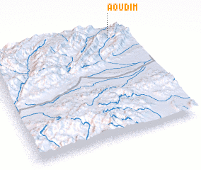 Places with similar names to Aoudim, Morocco ::
Disclaimer :: Information on this page comes without warranty of any kind |
||
|
Where is Aoudim? Elevation and coordinates ::
Latitude (lat): 31°59'0"N Longitude (lon): 5°7'0"W
Elevation (approx.): 1522m (map arrows pan, magnifying glasses zoom) |
||
|
Visiting Aoudim? Hotel/Accommodation ::
Book a hotel in Aoudim Travel Guide ::
Buy a travel guide for Morocco rental cars ::
car rental offers GPS waypoint ::
download a GPX waypoint (PoI) of Aoudim for your GPS receiver
|
||