|
search place name
|
||
Astif (Taroudannt, Morocco)Astif is a town in the Taroudannt region of Morocco. An overview map of the region around Astif is displayed below.
regional and 3d topo map of Astif, Morocco ::

Astif airports ::
The nearest airport is OZZ - Ouarzazate, located 99.2 km east of Astif.
Other airports nearby include RAK - Marrakech Menara (108.9 km north), AGA - Agadir Inezgane (162.1 km west), Nearby towns ::
Tissekht (1.9km north) //
Imi nʼ Derra (1.9km north) //
Tinlif (3.2km east) //
Agouni nʼ Ouderdour (4.0km south west) //
Talmentoukht (4.0km south west) //
Agouni nʼ Tleta (4.9km south east) //
Agouni nʼ Id Ou Illoun (4.9km north east) //
Touzdiine (4.8km east) //
Ouaouzrout (5.8km north) //
Tizzert (6.1km north west) //
Zaouia Tamaraout (6.4km north west) //
Tassila (7.4km north) //
Tala (6.6km east) //
Tabia nʼIrhil (7.6km south) //
Imider (7.3km north west) //
Alemsa (7.3km north east) //
Tassaga (7.3km south east) //
Tammast (7.3km north east) //
Ifradene (7.4km north east) //
Talemt (7.4km south west) //
Issougane (7.4km south west) //
Tamanart (8.8km north west) //
Agadir nʼ Oumerhdir (9.8km south east) //
Timicht (9.8km south east) //
El Klaat (9.8km north east) //
Agadir (9.8km north west) //
Tirhza (9.8km north west) //
[all distances 'as the bird flies' and approximate] 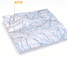 Places with similar names to Astif, Morocco ::
Disclaimer :: Information on this page comes without warranty of any kind |
||
|
Where is Astif? Elevation and coordinates ::
Latitude (lat): 30°38'0"N Longitude (lon): 7°53'0"W
Elevation (approx.): 1651m (map arrows pan, magnifying glasses zoom) |
||
|
Visiting Astif? Hotel/Accommodation ::
Book a hotel in Astif Travel Guide ::
Buy a travel guide for Morocco rental cars ::
car rental offers GPS waypoint ::
download a GPX waypoint (PoI) of Astif for your GPS receiver
|
||