|
search place name
|
||
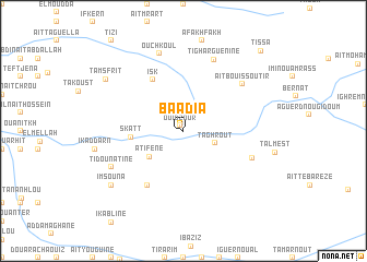
Baadia (Azilal, Morocco)Baadia is a town in the Azilal region of Morocco. An overview map of the region around Baadia is displayed below.
regional and 3d topo map of Baadia, Morocco ::
Baadia airports ::
The nearest airport is OZZ - Ouarzazate, located 100.8 km south of Baadia.
Other airports nearby include RAK - Marrakech Menara (135.0 km west), CMN - Casablanca Mohammed V Intl (194.0 km north west), Nearby towns ::
Ouidzour (0.6km north west) //
Taghrout (3.0km south east) //
Atifene (4.0km south west) //
Skatt (4.6km west) //
Isk (5.9km north west) //
Igourdane Aït Abbes (6.4km south west) //
Aït ‘Abbes (6.6km south east) //
Aït Bou Issoutir (7.0km north east) //
Tigharguenine (7.7km north) //
Ouchkoul (8.1km north) //
Tidou nʼAtine (7.3km south west) //
Imsouna (8.4km south west) //
Tamsfrit (8.6km north west) //
Tissa (10.6km north east) //
[all distances 'as the bird flies' and approximate] 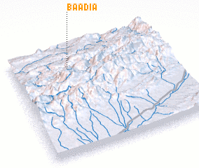 Places with similar names to Baadia, Morocco ::
Disclaimer :: Information on this page comes without warranty of any kind |
||
|
Where is Baadia? Elevation and coordinates ::
Latitude (lat): 31°49'0"N Longitude (lon): 6°38'0"W
Elevation (approx.): 1298m (map arrows pan, magnifying glasses zoom) |
||
|
Visiting Baadia? Hotel/Accommodation ::
Book a hotel in Baadia Travel Guide ::
Buy a travel guide for Morocco rental cars ::
car rental offers GPS waypoint ::
download a GPX waypoint (PoI) of Baadia for your GPS receiver
|
||