|
search place name
|
||
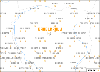
Bab el Mrouj (Taza, Morocco)Bab el Mrouj is a town in the Taza region of Morocco. An overview map of the region around Bab el Mrouj is displayed below.
regional and 3d topo map of Bab el Mrouj, Morocco ::
Bab el Mrouj airports ::
The nearest airport is AHU - Al Hociema Cherif El Idrissi, located 86.5 km north of Bab el Mrouj.
Other airports nearby include FEZ - Fez Saiss (101.3 km south west), MLN - Melilla (138.5 km north east), MEK - Meknes Bassatine (147.7 km south west), TTU - Tetouan Saniat Rmel (174.7 km north west), Nearby towns ::
Jemlila (2.4km north east) //
Bou Atrouch (2.4km south west) //
Tiliouane (3.6km south west) //
Atamna (4.0km north) //
Mehamra (4.8km south east) //
Dar Caïd Abd es Slam (5.6km south) //
El Karia (5.8km south) //
Saïda (5.8km south) //
Tahar Souk (5.8km south) //
El Karia (6.3km north east) //
Ifatna (6.3km south east) //
El Menzel (5.9km north west) //
Sidi Youssef (7.4km north) //
El Hmadna (7.6km south) //
Bounoua (7.2km south west) //
Khebabza (7.2km south west) //
Nbabla (8.0km south) //
Douar Bab Damsiouane (7.2km south east) //
[all distances 'as the bird flies' and approximate] 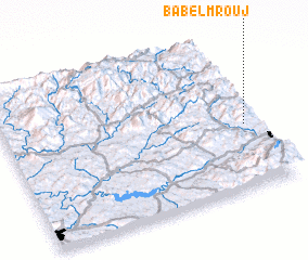 Places with similar names to Bab el Mrouj, Morocco :: Disclaimer :: Information on this page comes without warranty of any kind |
||
|
Where is Bab el Mrouj? Elevation and coordinates ::
Latitude (lat): 34°25'0"N Longitude (lon): 4°3'0"W
Elevation (approx.): 1073m (map arrows pan, magnifying glasses zoom) |
||
|
Visiting Bab el Mrouj? Hotel/Accommodation ::
Book a hotel in Bab el Mrouj Travel Guide ::
Buy a travel guide for Morocco rental cars ::
car rental offers GPS waypoint ::
download a GPX waypoint (PoI) of Bab el Mrouj for your GPS receiver
|
||