|
search place name
|
||
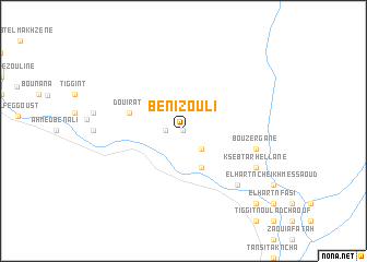
Beni Zouli (Ouarzazate, Morocco)Beni Zouli is a town in the Ouarzazate region of Morocco. An overview map of the region around Beni Zouli is displayed below.
regional and 3d topo map of Beni Zouli, Morocco ::
Beni Zouli airports ::
The nearest airport is OZZ - Ouarzazate, located 108.6 km north west of Beni Zouli.
Other airports nearby include ERH - Er-rachidia Moulay Ali Cherif (218.8 km north east), Nearby towns ::
Zaouia nʼTafroudst (0.0km north) //
Tafroudst (1.6km west) //
Zaouia Tafrout (2.4km south east) //
Ksabt el Kaaba (4.0km south east) //
Douirat (5.1km west) //
Bou Zergane (6.7km east) //
Zaouia el Cadi (7.3km south east) //
Sidi Bou Salah (7.3km south east) //
Ksebt Arhellane (7.4km south east) //
Tissergat (9.8km south east) //
El Aroumial (9.8km south east) //
[all distances 'as the bird flies' and approximate]  Places with similar names to Beni Zouli, Morocco ::
// Bounezzal (MA)
// Bansal (PH)
// Banzal (PH)
// Benzal (US)
// Bonsall (US)
// Bonzel (DE)
// Bonsal (DE)
// Banzola (IT)
// Banī Şāliḩ (IQ)
// Banī Şāliḩ (IQ)
Disclaimer :: Information on this page comes without warranty of any kind |
||
|
Where is Beni Zouli? Elevation and coordinates ::
Latitude (lat): 30°28'0"N Longitude (lon): 5°55'0"W
Elevation (approx.): 762m (map arrows pan, magnifying glasses zoom) |
||
|
Visiting Beni Zouli? Hotel/Accommodation ::
Book a hotel in Beni Zouli Travel Guide ::
Buy a travel guide for Morocco rental cars ::
car rental offers GPS waypoint ::
download a GPX waypoint (PoI) of Beni Zouli for your GPS receiver
|
||