|
search place name
|
||
Benrougal (El Kelaa des Sraghna, Morocco)Benrougal is a town in the El Kelaa des Sraghna region of Morocco. An overview map of the region around Benrougal is displayed below.
regional and 3d topo map of Benrougal, Morocco ::

Benrougal airports ::
The nearest airport is RAK - Marrakech Menara, located 75.3 km west of Benrougal.
Other airports nearby include OZZ - Ouarzazate (90.4 km south), CMN - Casablanca Mohammed V Intl (187.7 km north), Nearby towns ::
Sidi Bou Jemaa (1.9km north) //
Aït el Haj (1.9km north) //
Tagoudaft (2.4km south west) //
Bou Achiba (3.2km west) //
Talkount (4.0km south west) //
Douar Haddou Azour (3.7km north east) //
Agadir (4.3km west) //
Mellah de Tidili (4.9km north east) //
Aït Bou Hamra (4.7km east) //
Mellah (4.7km west) //
Ksar Oulad Mansour (4.7km west) //
Oulad Bissi (4.7km west) //
Aït el Grachoua (4.7km east) //
Zouiat Taglaout (5.4km north west) //
Agad el Kadir (5.1km east) //
Douar Sidi Ahmed Lahoussine (5.8km north) //
Timi nʼOutine (5.8km south) //
Aït Mesdo (6.0km north east) //
Aït Adel (7.4km south) //
Aït Iheda (6.6km east) //
Aflar Mohammed nʼAït Kadder (6.6km east) //
Sidi Bou Salah (6.6km east) //
Oulad Mançour (7.3km north west) //
El Mnaïra (8.7km north east) //
Douar Yakoubi (8.4km north east) //
Oulad Ouggad (9.6km north west) //
[all distances 'as the bird flies' and approximate] 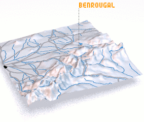 Places with similar names to Benrougal, Morocco ::
// Ban Rai Kluai (TH)
Disclaimer :: Information on this page comes without warranty of any kind |
||
|
Where is Benrougal? Elevation and coordinates ::
Latitude (lat): 31°42'0"N Longitude (lon): 7°15'0"W
Elevation (approx.): 883m (map arrows pan, magnifying glasses zoom) |
||
|
Visiting Benrougal? Hotel/Accommodation ::
Book a hotel in Benrougal Travel Guide ::
Buy a travel guide for Morocco rental cars ::
car rental offers GPS waypoint ::
download a GPX waypoint (PoI) of Benrougal for your GPS receiver
|
||