|
search place name
|
||
Boumalne (Ouarzazate, Morocco)Boumalne is a town in the Ouarzazate region of Morocco. An overview map of the region around Boumalne is displayed below.
regional and 3d topo map of Boumalne, Morocco ::

Boumalne airports ::
The nearest airport is OZZ - Ouarzazate, located 100.2 km south west of Boumalne.
Other airports nearby include ERH - Er-rachidia Moulay Ali Cherif (163.7 km north east), CMN - Casablanca Mohammed V Intl (266.6 km north west), Nearby towns ::
Aït Slilo (0.9km north east) //
Aït Slimane (0.9km east) //
Aït bou Oualal (1.9km south east) //
Aït Bou Allal (1.9km south east) //
Tarmoucht (2.3km south) //
Aït Messaoud (2.8km north) //
Aït Abdoun (3.6km south) //
Tighrematine nʼel Had Aghroud (3.9km north) //
Aït Ishaq (4.0km north) //
Aït Youl (4.9km north) //
Aït Abdoun (5.4km south) //
Aït Ben Ali (6.2km north) //
Zouiet Sidi Bou Beker (7.2km north) //
Aït Ouahi (7.3km south) //
Tamellalt (7.7km north) //
Imzoudar (8.0km north) //
Aït Ouglif (8.5km north) //
Aït Ibrirene (8.5km north west) //
Aït el Arbi (8.9km north) //
Knemis Dades (8.8km south west) //
[all distances 'as the bird flies' and approximate] 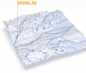 Places with similar names to Boumalne, Morocco ::
Disclaimer :: Information on this page comes without warranty of any kind |
||
|
Where is Boumalne? Elevation and coordinates ::
Latitude (lat): 31°22'54"N Longitude (lon): 5°59'34"W
Elevation (approx.): 1537m (map arrows pan, magnifying glasses zoom) |
||
|
Visiting Boumalne? Hotel/Accommodation ::
Book a hotel in Boumalne Travel Guide ::
Buy a travel guide for Morocco rental cars ::
car rental offers GPS waypoint ::
download a GPX waypoint (PoI) of Boumalne for your GPS receiver
|
||