|
search place name
|
||
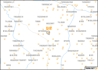
Dir (Taroudannt, Morocco)Dir is a town in the Taroudannt region of Morocco. An overview map of the region around Dir is displayed below.
regional and 3d topo map of Dir, Morocco ::
Dir airports ::
The nearest airport is AGA - Agadir Inezgane, located 103.0 km west of Dir.
Other airports nearby include RAK - Marrakech Menara (151.3 km north), OZZ - Ouarzazate (166.5 km north east), Nearby towns ::
Adar nʼ Oualaene (2.0km south east) //
Talat nʼ Iferd (2.2km south) //
Aït Blal (2.2km north) //
Azarharane (2.2km north) //
Tilkist (2.0km west) //
Aït Aïssa (2.0km west) //
Aït Ibourk (2.9km north west) //
Irhir nʼOuamane (2.9km north west) //
Megzart (3.4km north) //
Taourirt nʼOurhamoun (3.6km south) //
Sagour (3.6km north east) //
Oualeksene (3.5km east) //
Iguer (3.6km west) //
Mekt (4.4km south east) //
Dar Ou el Kadi (5.2km south) //
Tagadirt nʼAït Idir (5.2km south) //
Agouni nʼ Ouaggoug (4.9km south west) //
Ouanzouki (5.4km south) //
Tifrit (5.4km south) //
Assifid (5.6km south) //
Tabia (5.4km north west) //
Oulkadi (5.8km south) //
Tilioua (5.6km north east) //
Tazermant (6.2km north) //
Issedrim (6.5km south) //
Tagadirt (6.0km east) //
Aït Ibourk (6.5km south east) //
Talat (6.9km south east) //
Agserane (6.4km east) //
[all distances 'as the bird flies' and approximate]  Places with similar names to Dir, Morocco ::
Disclaimer :: Information on this page comes without warranty of any kind |
||
|
Where is Dir? Elevation and coordinates ::
Latitude (lat): 30°17'49"N Longitude (lon): 8°28'47"W
Elevation (approx.): 1260m (map arrows pan, magnifying glasses zoom) |
||
|
Visiting Dir? Hotel/Accommodation ::
Book a hotel in Dir Travel Guide ::
Buy a travel guide for Morocco rental cars ::
car rental offers GPS waypoint ::
download a GPX waypoint (PoI) of Dir for your GPS receiver
|
||