|
search place name
|
||
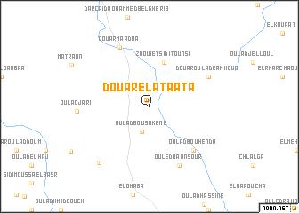
Douar el Ataata (El Jadida, Morocco)Douar el Ataata is a town in the El Jadida region of Morocco. An overview map of the region around Douar el Ataata is displayed below.
regional and 3d topo map of Douar el Ataata, Morocco ::
Douar el Ataata airports ::
The nearest airport is CMN - Casablanca Mohammed V Intl, located 102.3 km north east of Douar el Ataata.
Other airports nearby include RAK - Marrakech Menara (106.8 km south), RBA - Rabat Sale (209.0 km north east), OZZ - Ouarzazate (214.5 km south east), NNA - Kentira Kenitra (239.5 km north east), Nearby towns ::
Oulad Bou Sakene (3.2km south) //
Zaouiet Sidi Tounsi (5.8km north) //
Oulad Bou Henda (7.3km south east) //
Douar Oulad Rahmoun (7.3km north east) //
Dar Caïd Tounsi (8.0km north west) //
Douar Maadna (8.0km north west) //
Ouled Mannsour (8.0km south east) //
Douar Abbes Ben Tounsi (8.9km south west) //
[all distances 'as the bird flies' and approximate] 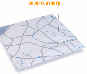 Places with similar names to Douar el Ataata, Morocco ::
// Douar el Aouidat (MA)
// Dar Oulad Daoued (TN)
// Dera Aladād (PK)
// Douar Oulad Aïd (MA)
// Douar Oulad Aïd (MA)
// Douar Oulad Adda (DZ)
// Douar Oulad Aoued (DZ)
// Douar Oulad Taoui (DZ)
// Douar Oulad et Taoui (DZ)
// Douar Oulad Ouada (DZ)
Disclaimer :: Information on this page comes without warranty of any kind |
||
|
Where is Douar el Ataata? Elevation and coordinates ::
Latitude (lat): 32°34'0"N Longitude (lon): 8°8'0"W
Elevation (approx.): 283m (map arrows pan, magnifying glasses zoom) |
||
|
Visiting Douar el Ataata? Hotel/Accommodation ::
Book a hotel in Douar el Ataata Travel Guide ::
Buy a travel guide for Morocco rental cars ::
car rental offers GPS waypoint ::
download a GPX waypoint (PoI) of Douar el Ataata for your GPS receiver
|
||