|
search place name
|
||
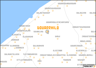
Douar Rhila (El Jadida, Morocco)Douar Rhila is a town in the El Jadida region of Morocco. An overview map of the region around Douar Rhila is displayed below.
regional and 3d topo map of Douar Rhila, Morocco ::
Douar Rhila airports ::
The nearest airport is RAK - Marrakech Menara, located 149.1 km south east of Douar Rhila.
Other airports nearby include CMN - Casablanca Mohammed V Intl (150.7 km north east), Nearby towns ::
Douar el Hamidat (2.3km west) //
Sidi Belaïd (3.1km west) //
Dhaji (3.6km south east) //
Douar Khama (3.6km north east) //
Douar Moulay Achafgane (4.8km north east) //
Oulad Amira (6.4km south west) //
Ahiout El Kohia (7.3km north west) //
Oulad Youssef (7.6km north) //
Douar Haibut Chaïr (6.5km west) //
Oualidia (7.2km north west) //
Zaouïa (7.2km south west) //
El Kouasma (6.9km west) //
El Azzaba (8.0km south east) //
Douar Msabha (9.7km south east) //
Tleta Bouariss (10.7km south west) //
[all distances 'as the bird flies' and approximate] 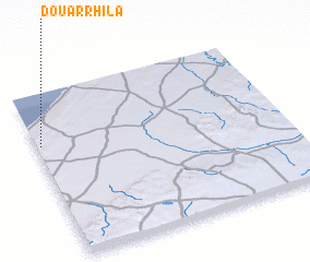 Places with similar names to Douar Rhila, Morocco ::
// Douar Rahalia (MA)
// Dry Hill (US)
// Terhalle (DE)
// Turhal (TR)
// Terhalla (TN)
// Tarahal (ES)
// Torrihuela (ES)
// Dryhill (US)
// Tar Hill (US)
// Tory Hill (US)
Disclaimer :: Information on this page comes without warranty of any kind |
||
|
Where is Douar Rhila? Elevation and coordinates ::
Latitude (lat): 32°41'0"N Longitude (lon): 8°59'0"W
Elevation (approx.): 144m (map arrows pan, magnifying glasses zoom) |
||
|
Visiting Douar Rhila? Hotel/Accommodation ::
Book a hotel in Douar Rhila Travel Guide ::
Buy a travel guide for Morocco rental cars ::
car rental offers GPS waypoint ::
download a GPX waypoint (PoI) of Douar Rhila for your GPS receiver
|
||