|
search place name
|
||
El Haït (Ouarzazate, Morocco)El Haït is a town in the Ouarzazate region of Morocco. An overview map of the region around El Haït is displayed below.
regional and 3d topo map of El Haït, Morocco ::

El Haït airports ::
The nearest airport is OZZ - Ouarzazate, located 81.0 km north of El Haït.
Other airports nearby include RAK - Marrakech Menara (183.4 km north west), Nearby towns ::
Nosoula (2.2km north east) //
Tamda (3.8km east) //
Imi nʼTlit (5.9km north west) //
Aguerd (8.5km north west) //
Taourirt nʼTilles (9.0km north west) //
Aougni (9.9km north west) //
Tagadirt (9.9km north west) //
Serb (9.9km north west) //
Taourirt nʼOuznag (9.9km north west) //
Kioud (10.0km north west) //
Zaouia Sidi Merri (10.9km north west) //
Aghgoumi (11.5km north west) //
[all distances 'as the bird flies' and approximate] 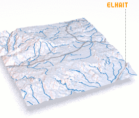 Places with similar names to El Haït, Morocco ::
Disclaimer :: Information on this page comes without warranty of any kind |
||
|
Where is El Haït? Elevation and coordinates ::
Latitude (lat): 30°12'46"N Longitude (lon): 7°0'15"W
Elevation (approx.): 808m (map arrows pan, magnifying glasses zoom) |
||
|
Visiting El Haït? Hotel/Accommodation ::
Book a hotel in El Haït Travel Guide ::
Buy a travel guide for Morocco rental cars ::
car rental offers GPS waypoint ::
download a GPX waypoint (PoI) of El Haït for your GPS receiver
|
||