|
search place name
|
||
El Heri (Taroudannt, Morocco)El Heri is a town in the Taroudannt region of Morocco. An overview map of the region around El Heri is displayed below.
regional and 3d topo map of El Heri, Morocco ::

El Heri airports ::
The nearest airport is AGA - Agadir Inezgane, located 48.9 km north west of El Heri.
Other airports nearby include RAK - Marrakech Menara (185.3 km north east), Nearby towns ::
Ou Yassine (1.6km west) //
Assergous (2.6km south west) //
Tidsi (3.7km north) //
Aït Yamzel (3.7km south) //
Tafraout (3.2km west) //
El Khemis (3.7km north east) //
Imi Ougadir (3.7km north east) //
Fifri (4.0km south east) //
Banoun (4.1km east) //
Imi nʼTsil (4.9km south east) //
Afayane (4.9km south west) //
Aït Ouzzal (5.8km south) //
Oumsdikt (5.1km east) //
El Tieta (5.1km west) //
Tadouart (6.0km north west) //
Ti nʼAli (6.1km south east) //
Igalioun (6.4km south west) //
Adouz (6.4km south west) //
Anzad (6.3km south west) //
Tassila (6.4km west) //
Naïma (7.6km north) //
Iferiadene (7.7km south) //
Tislane Isk (7.4km south west) //
El Kebir (8.1km north west) //
Amchtoutel (7.5km east) //
Tazaouaght (8.7km south west) //
Laazib (8.8km north west) //
Aït Nisser (9.8km south west) //
[all distances 'as the bird flies' and approximate] 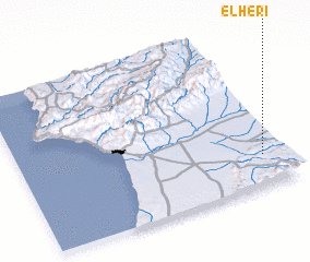 Places with similar names to El Heri, Morocco ::
// El Haouari (MA)
// El Horra (MA)
// El Haouaria (TN)
// El Héour (TD)
// El Ahorra (MX)
// El Hara (LB)
// El Hâra (LB)
// El Hâra (LB)
// Elahera (LK)
// El Hierro (VE)
Disclaimer :: Information on this page comes without warranty of any kind |
||
|
Where is El Heri? Elevation and coordinates ::
Latitude (lat): 30°12'0"N Longitude (lon): 9°5'0"W
Elevation (approx.): 509m (map arrows pan, magnifying glasses zoom) |
||
|
Visiting El Heri? Hotel/Accommodation ::
Book a hotel in El Heri Travel Guide ::
Buy a travel guide for Morocco rental cars ::
car rental offers GPS waypoint ::
download a GPX waypoint (PoI) of El Heri for your GPS receiver
|
||