|
search place name
|
||
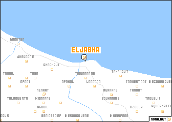
El Jabha (Chaouen, Morocco)El Jabha is a town in the Chaouen region of Morocco. An overview map of the region around El Jabha is displayed below.
regional and 3d topo map of El Jabha, Morocco ::
El Jabha airports ::
The nearest airport is TTU - Tetouan Saniat Rmel, located 72.6 km north west of El Jabha.
Other airports nearby include AHU - Al Hociema Cherif El Idrissi (75.5 km east), GIB - Gibraltar (120.7 km north west), TNG - Tanger Ibn Batouta (126.8 km north west), FEZ - Fez Saiss (145.9 km south), Nearby towns ::
 Places with similar names to El Jabha, Morocco :: Disclaimer :: Information on this page comes without warranty of any kind |
||
|
Where is El Jabha? Elevation and coordinates ::
Latitude (lat): 35°13'0"N Longitude (lon): 4°40'0"W
Elevation (approx.): -32768m (map arrows pan, magnifying glasses zoom) |
||
|
Visiting El Jabha? Hotel/Accommodation ::
Book a hotel in El Jabha Travel Guide ::
Buy a travel guide for Morocco rental cars ::
car rental offers GPS waypoint ::
download a GPX waypoint (PoI) of El Jabha for your GPS receiver
|
||