|
search place name
|
||
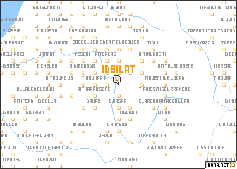
Id Bilat (Tiznit, Morocco)Id Bilat is a town in the Tiznit region of Morocco. An overview map of the region around Id Bilat is displayed below.
regional and 3d topo map of Id Bilat, Morocco ::
Id Bilat airports ::
The nearest airport is AGA - Agadir Inezgane, located 119.6 km north of Id Bilat.
Other airports nearby include TTA - Tan Tan Plage Blanche (154.7 km south west), TIN - Tindouf (255.2 km south east), Nearby towns ::
Tiourhza (1.9km north) //
Akalmun (1.9km north) //
Sidi Hossaïn (1.9km north) //
Tisfatine (1.6km west) //
Mumirak (1.9km north) //
Sidi Achaïne (1.9km south) //
Id Daud (1.9km south) //
Bu Afernun (2.5km north west) //
Akiau (2.5km north east) //
Mohammed Ou Lahsene (2.5km north east) //
Bou Salim (2.5km north east) //
Ait Susan (3.7km north) //
Talak Imakern (3.7km north) //
Tinoumart (3.2km west) //
Tasila (3.2km west) //
Hanut (3.2km east) //
Sidi Slimane (3.7km south) //
Id Nasar (3.7km south) //
Iguisene (3.2km east) //
Ait Cacas (4.0km north west) //
Tiyut (4.0km north west) //
Id U el Ihia (3.7km north west) //
Id Ben Aomar (3.7km north west) //
Aït Harrasene (3.7km south west) //
Dahet (3.7km south west) //
Bou Sagoun (3.7km north east) //
El Aïn (3.7km north east) //
Id Bu Sabum (3.7km north east) //
Idmeschiren (4.0km south east) //
[all distances 'as the bird flies' and approximate]  Places with similar names to Id Bilat, Morocco :: Disclaimer :: Information on this page comes without warranty of any kind |
||
|
Where is Id Bilat? Elevation and coordinates ::
Latitude (lat): 29°22'0"N Longitude (lon): 9°58'0"W
Elevation (approx.): 313m (map arrows pan, magnifying glasses zoom) |
||
|
Visiting Id Bilat? Hotel/Accommodation ::
Book a hotel in Id Bilat Travel Guide ::
Buy a travel guide for Morocco rental cars ::
car rental offers GPS waypoint ::
download a GPX waypoint (PoI) of Id Bilat for your GPS receiver
|
||