|
search place name
|
||
Ighalene (Marrakech, Morocco)Ighalene is a town in the Marrakech region of Morocco. An overview map of the region around Ighalene is displayed below.
regional and 3d topo map of Ighalene, Morocco ::

Ighalene airports ::
The nearest airport is RAK - Marrakech Menara, located 52.0 km north west of Ighalene.
Other airports nearby include OZZ - Ouarzazate (78.6 km south east), AGA - Agadir Inezgane (218.6 km south west), Nearby towns ::
Aït Ouaïrri (1.6km west) //
Igoudmane (1.9km north) //
Assammer (2.4km north west) //
Taghallaït (3.1km west) //
Tifist (3.7km north) //
Halaout (3.2km west) //
Matous (3.2km west) //
Ihlalene (4.7km east) //
Oufadma (4.7km east) //
Adarza (6.0km south) //
Asloun (6.0km north east) //
El Bour (6.4km north east) //
Tahrzout (6.3km east) //
Tichki (6.6km west) //
Azgour (6.6km east) //
Ikkis (7.3km south east) //
Talatast (7.3km north east) //
Tazerzat (7.3km north west) //
Izrafene (6.9km east) //
Arbaʼ Tighedouine (7.7km north east) //
Ouaifir (8.1km north east) //
Tabia (8.1km north east) //
Aït Slimane (7.3km north east) //
Oui nʼImstene (8.9km south east) //
Mellah (9.7km north east) //
Tizert (9.8km south east) //
[all distances 'as the bird flies' and approximate] 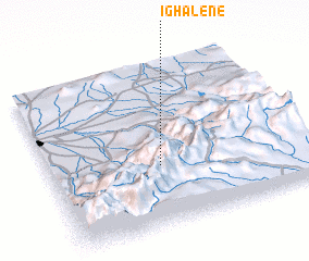
Disclaimer :: Information on this page comes without warranty of any kind |
||
|
Where is Ighalene? Elevation and coordinates ::
Latitude (lat): 31°22'0"N Longitude (lon): 7°34'0"W
Elevation (approx.): 1922m (map arrows pan, magnifying glasses zoom) |
||
|
Visiting Ighalene? Hotel/Accommodation ::
Book a hotel in Ighalene Travel Guide ::
Buy a travel guide for Morocco rental cars ::
car rental offers GPS waypoint ::
download a GPX waypoint (PoI) of Ighalene for your GPS receiver
|
||