|
search place name
|
||
Imdras (Taroudannt, Morocco)Imdras is a town in the Taroudannt region of Morocco. An overview map of the region around Imdras is displayed below.
regional and 3d topo map of Imdras, Morocco ::

Imdras airports ::
The nearest airport is AGA - Agadir Inezgane, located 110.7 km west of Imdras.
Other airports nearby include RAK - Marrakech Menara (136.1 km north), OZZ - Ouarzazate (153.6 km north east), Nearby towns ::
Iguedad (0.9km north east) //
Aït Mimoun (1.6km north) //
Tachtoult (2.1km south) //
Iguedad (2.2km south) //
Tifguit (2.4km south east) //
Tizgui (2.7km south) //
Tagadirt nʼ Ighalene (3.0km north west) //
Tanegounsa (3.0km south west) //
Sidi Bel Abbes (3.6km north) //
Bou Tamert (3.8km north) //
Aït Idir (3.5km east) //
Tiouririne (4.0km north west) //
Aït Tajer (4.3km north) //
Tachtoult (4.1km north east) //
Aït Ibourk (4.0km north west) //
Aït Herechid (4.4km north east) //
Maguenoun (4.5km south west) //
Ida Ou Bidene (4.5km south west) //
Tiouririne (4.3km east) //
Tizgui nʼOuarhem (4.8km south east) //
Tilmezdight (4.7km west) //
Tirmerst (4.8km south east) //
Aglaguel (5.4km south west) //
Ihassanine (5.9km south) //
Tirguitine (5.9km south) //
Aït Hassene (5.5km north east) //
Imskre (5.3km west) //
Tabia (6.2km south) //
Aït Daoud (5.5km west) //
[all distances 'as the bird flies' and approximate] 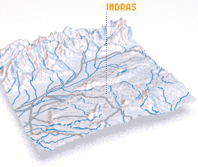 Places with similar names to Imdras, Morocco ::
// Imdras (MA)
Disclaimer :: Information on this page comes without warranty of any kind |
||
|
Where is Imdras? Elevation and coordinates ::
Latitude (lat): 30°25'9"N Longitude (lon): 8°23'42"W
Elevation (approx.): 1301m (map arrows pan, magnifying glasses zoom) |
||
|
Visiting Imdras? Hotel/Accommodation ::
Book a hotel in Imdras Travel Guide ::
Buy a travel guide for Morocco rental cars ::
car rental offers GPS waypoint ::
download a GPX waypoint (PoI) of Imdras for your GPS receiver
|
||