|
search place name
|
||
Imjad (Tiznit, Morocco)Imjad is a town in the Tiznit region of Morocco. An overview map of the region around Imjad is displayed below.
regional and 3d topo map of Imjad, Morocco ::

Imjad airports ::
The nearest airport is AGA - Agadir Inezgane, located 87.3 km north west of Imjad.
Other airports nearby include TTA - Tan Tan Plage Blanche (236.6 km south west), TIN - Tindouf (238.8 km south east), RAK - Marrakech Menara (240.8 km north east), Nearby towns ::
Aouzert (0.0km north) //
Tiklfist (1.9km north) //
Aït Abdallah (2.5km south east) //
Azou Roudrig (3.7km north) //
Tiourhza (3.7km north west) //
Tarhatine (3.7km north west) //
Ifrhassene (4.0km south west) //
Azour nʼAït Lahsene (3.7km north east) //
Tizi nʼKida (4.9km north east) //
Agouni Arech (4.9km south east) //
Safirest (5.8km south) //
Taourirt (5.8km north) //
Akal nʼTini (5.8km north) //
Taguelmoust (6.1km north west) //
Salioua (6.4km south west) //
Aït Ouaskhine (6.1km south west) //
Lʼ Kasbour (6.4km west) //
Dourtane (7.4km north) //
Ifrhel (7.4km north) //
Irhir nʼ Aït Abbes (7.4km south) //
Tirhmert (6.4km east) //
Adekhs (7.6km north) //
Irnoufa (7.6km south) //
Aït Mar (6.7km east) //
Tizi nʼImoucheoun (7.6km south) //
Aït Debachine (6.7km east) //
Tamaloukt (7.4km north west) //
Tajgalt (7.4km south east) //
Ihasern (7.4km north west) //
[all distances 'as the bird flies' and approximate] 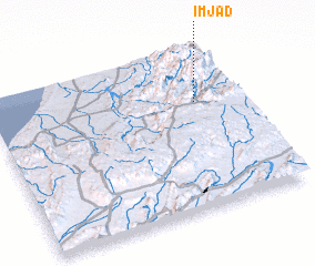
Disclaimer :: Information on this page comes without warranty of any kind |
||
|
Where is Imjad? Elevation and coordinates ::
Latitude (lat): 29°40'0"N Longitude (lon): 9°10'0"W
Elevation (approx.): 1119m (map arrows pan, magnifying glasses zoom) |
||
|
Visiting Imjad? Hotel/Accommodation ::
Book a hotel in Imjad Travel Guide ::
Buy a travel guide for Morocco rental cars ::
car rental offers GPS waypoint ::
download a GPX waypoint (PoI) of Imjad for your GPS receiver
|
||