|
search place name
|
||
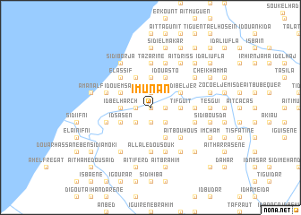
Imunan (Tiznit, Morocco)Imunan is a town in the Tiznit region of Morocco. An overview map of the region around Imunan is displayed below.
regional and 3d topo map of Imunan, Morocco ::
Imunan airports ::
The nearest airport is AGA - Agadir Inezgane, located 120.5 km north east of Imunan.
Other airports nearby include TTA - Tan Tan Plage Blanche (148.9 km south west), TIN - Tindouf (265.8 km south east), Nearby towns ::
Id Busnina (0.0km north) //
Id Bel Hach (0.0km north) //
Janfuf (1.6km east) //
Chorfa (1.9km south) //
Busdadi (1.9km south) //
Id Mouangane (1.6km west) //
Kaid Salah (1.6km west) //
Senagra (1.6km west) //
Id El Hach (1.9km north) //
Id Bousmaïna (1.9km north) //
Id Cheleh (2.5km south east) //
Id Mehais (2.5km south west) //
Bukdur (2.5km south west) //
Tifguit (3.2km east) //
Hamed U Ali (3.2km east) //
Id Ougni (3.7km north) //
Id Bel Harch (3.2km west) //
Timhata (4.0km south east) //
Dar Afoud (4.0km south east) //
Id Ou Asto (4.0km north east) //
Id Yuaiga (3.7km north east) //
Moulay Ihia (3.7km north east) //
Sidi Beljer (3.7km north east) //
Id Ourach (4.0km north west) //
Berrezmat (4.0km north west) //
Id Sasen (3.7km south west) //
Boukdour (3.7km south west) //
Id Ou Emsaït (3.7km north west) //
Aït Ben Cherif (4.9km south east) //
[all distances 'as the bird flies' and approximate]  Places with similar names to Imunan, Morocco ::
Disclaimer :: Information on this page comes without warranty of any kind |
||
|
Where is Imunan? Elevation and coordinates ::
Latitude (lat): 29°24'0"N Longitude (lon): 10°5'0"W
Elevation (approx.): 135m (map arrows pan, magnifying glasses zoom) |
||
|
Visiting Imunan? Hotel/Accommodation ::
Book a hotel in Imunan Travel Guide ::
Buy a travel guide for Morocco rental cars ::
car rental offers GPS waypoint ::
download a GPX waypoint (PoI) of Imunan for your GPS receiver
|
||