|
search place name
|
||
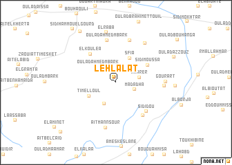
Lehlalat (Marrakech, Morocco)Lehlalat is a town in the Marrakech region of Morocco. An overview map of the region around Lehlalat is displayed below.
regional and 3d topo map of Lehlalat, Morocco ::
Lehlalat airports ::
The nearest airport is RAK - Marrakech Menara, located 103.7 km east of Lehlalat.
Other airports nearby include AGA - Agadir Inezgane (129.3 km south), CMN - Casablanca Mohammed V Intl (253.2 km north east), Nearby towns ::
Madadha (2.8km south east) //
Oulad Ahmed Mbark (3.5km north west) //
Mharer (3.3km east) //
Ouled Mimoun (3.8km south west) //
Sfia (4.3km north east) //
Timelloul (4.3km south west) //
Sidi Moussa (5.3km north east) //
El Koulea (5.8km north west) //
Sidi Dou (6.3km south east) //
Ouled Moumene (6.5km south east) //
Oulad Ahmed Mbark (6.9km north) //
El Koulea (7.1km north) //
Aït Mannsour (7.5km south) //
Oulad el Hajj (6.7km east) //
Oulad Sidi Abdallah (7.5km north east) //
Gourart (6.9km east) //
El Raba (8.2km north) //
Oulad Saïd (9.6km north west) //
Sidi Hammou el Gourd (10.6km north west) //
Koura (11.0km south west) //
[all distances 'as the bird flies' and approximate] 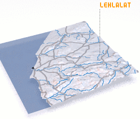 Places with similar names to Lehlalat, Morocco ::
Disclaimer :: Information on this page comes without warranty of any kind |
||
|
Where is Lehlalat? Elevation and coordinates ::
Latitude (lat): 31°29'19"N Longitude (lon): 9°7'12"W
Elevation (approx.): 444m (map arrows pan, magnifying glasses zoom) |
||
|
Visiting Lehlalat? Hotel/Accommodation ::
Book a hotel in Lehlalat Travel Guide ::
Buy a travel guide for Morocco rental cars ::
car rental offers GPS waypoint ::
download a GPX waypoint (PoI) of Lehlalat for your GPS receiver
|
||