|
search place name
|
||
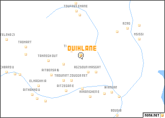
Ouihlane (Er Rachidia, Morocco)Ouihlane is a town in the Er Rachidia region of Morocco. An overview map of the region around Ouihlane is displayed below.
regional and 3d topo map of Ouihlane, Morocco ::
Ouihlane airports ::
The nearest airport is ERH - Er-rachidia Moulay Ali Cherif, located 99.9 km north east of Ouihlane.
Other airports nearby include OZZ - Ouarzazate (189.4 km west), Nearby towns ::
Timezrit (2.8km north west) //
Agzdou nʼImasgat (3.2km south) //
Minarhirem (4.0km south east) //
Tabouirigt (3.9km west) //
Taourirt Zouggaret (5.3km south west) //
Aït Aomar Ou Ali (6.1km south west) //
Tachʼoufit (6.8km south) //
Tamreghout (6.7km west) //
Aït Ben Saïd (7.1km south west) //
Aït Zegane (7.9km south west) //
Mimarighéne (8.7km south) //
Amgane (8.9km south east) //
Ihandar (9.5km south east) //
Tagherat (9.2km north east) //
Tazoulaït (11.2km south east) //
[all distances 'as the bird flies' and approximate] 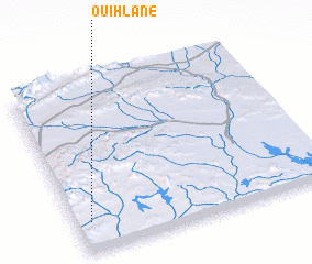 Places with similar names to Ouihlane, Morocco ::
Disclaimer :: Information on this page comes without warranty of any kind |
||
|
Where is Ouihlane? Elevation and coordinates ::
Latitude (lat): 31°10'37"N Longitude (lon): 4°56'40"W
Elevation (approx.): 812m (map arrows pan, magnifying glasses zoom) |
||
|
Visiting Ouihlane? Hotel/Accommodation ::
Book a hotel in Ouihlane Travel Guide ::
Buy a travel guide for Morocco rental cars ::
car rental offers GPS waypoint ::
download a GPX waypoint (PoI) of Ouihlane for your GPS receiver
|
||