|
search place name
|
||
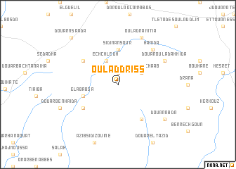
Oulad Driss (Marrakech, Morocco)Oulad Driss is a town in the Marrakech region of Morocco. An overview map of the region around Oulad Driss is displayed below.
regional and 3d topo map of Oulad Driss, Morocco ::
Oulad Driss airports ::
The nearest airport is RAK - Marrakech Menara, located 41.4 km south east of Oulad Driss.
Other airports nearby include OZZ - Ouarzazate (171.3 km south east), CMN - Casablanca Mohammed V Intl (181.1 km north east), AGA - Agadir Inezgane (200.3 km south west), Nearby towns ::
Haiane (1.9km north) //
Douar ech Chaab (3.7km north east) //
Ech-Chleuh (4.0km north west) //
Sidi Mansour (5.6km north) //
El Ababsa (5.1km west) //
Douar el Hajra (6.4km south east) //
Oulad Saïd el Ahmar (6.0km north west) //
Douar Belal (6.0km south west) //
Hamida (7.3km north east) //
Oulad-Ramitia (8.1km north east) //
Douar Oulad Ahmida (7.3km north east) //
Douar Abda (8.4km south east) //
Douar Msaada (9.7km north west) //
[all distances 'as the bird flies' and approximate] 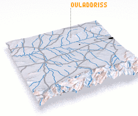 Places with similar names to Oulad Driss, Morocco ::
// Oulad Driss (MA)
// Oldrões (PT)
// Ołtarzew (PL)
// Oldřiš (CZ)
// Oulad Driss (MA)
// Oulad Driss (MA)
// Oulad Driss (MA)
// Oldřiš (CZ)
// Oldřiš (CZ)
// Oldřiš (CZ)
Disclaimer :: Information on this page comes without warranty of any kind |
||
|
Where is Oulad Driss? Elevation and coordinates ::
Latitude (lat): 31°52'0"N Longitude (lon): 8°21'0"W
Elevation (approx.): 453m (map arrows pan, magnifying glasses zoom) |
||
|
Visiting Oulad Driss? Hotel/Accommodation ::
Book a hotel in Oulad Driss Travel Guide ::
Buy a travel guide for Morocco rental cars ::
car rental offers GPS waypoint ::
download a GPX waypoint (PoI) of Oulad Driss for your GPS receiver
|
||