|
search place name
|
||
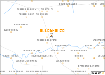
Oulad Hamza (Beni Mellal, Morocco)Oulad Hamza is a town in the Beni Mellal region of Morocco. An overview map of the region around Oulad Hamza is displayed below.
regional and 3d topo map of Oulad Hamza, Morocco ::
Oulad Hamza airports ::
The nearest airport is CMN - Casablanca Mohammed V Intl, located 127.6 km north west of Oulad Hamza.
Other airports nearby include RAK - Marrakech Menara (135.3 km south west), OZZ - Ouarzazate (158.3 km south), RBA - Rabat Sale (187.5 km north), MEK - Meknes Bassatine (212.7 km north east), Nearby towns ::
Ksar Derrag (1.6km west) //
Douar Oulad Nifaoui (2.4km south west) //
Douar Hababza (4.9km south east) //
Dar Ould Zidouh (5.8km south) //
Oulad Mbark (8.0km north west) //
Douar Oulad Soltane (8.0km south west) //
Douar Oulad Zaer (8.4km south west) //
[all distances 'as the bird flies' and approximate] 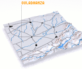 Places with similar names to Oulad Hamza, Morocco ::
Disclaimer :: Information on this page comes without warranty of any kind |
||
|
Where is Oulad Hamza? Elevation and coordinates ::
Latitude (lat): 32°22'0"N Longitude (lon): 6°55'0"W
Elevation (approx.): 375m (map arrows pan, magnifying glasses zoom) |
||
|
Visiting Oulad Hamza? Hotel/Accommodation ::
Book a hotel in Oulad Hamza Travel Guide ::
Buy a travel guide for Morocco rental cars ::
car rental offers GPS waypoint ::
download a GPX waypoint (PoI) of Oulad Hamza for your GPS receiver
|
||